

The Bailey Range Traverse
Olympic National Park's classic high route


Ever since high school, when I completed a backpacking trip through the High Divide with my father, I’ve been fascinated by the Bailey Range. Nestled in the heart of Olympic National Park, wrapping around Mount Olympus and the Hoh River, the range represents one of the most rugged zones in the state of Washington, much of it only recently deglaciated, above treeline, and completely off-trail.
Last winter, I stumbled upon Climber Kyle’s excellent trip report and was even more enthralled by the prospect of completing the traverse. With the addition of ending the traverse by crossing the Humes, Hoh, and Blue glaciers to turn it into a loop (and staying at the legendary Camp Pan), it seemed like a perfect adventure, and I added it to my shortlist of trips I wanted to complete this summer.
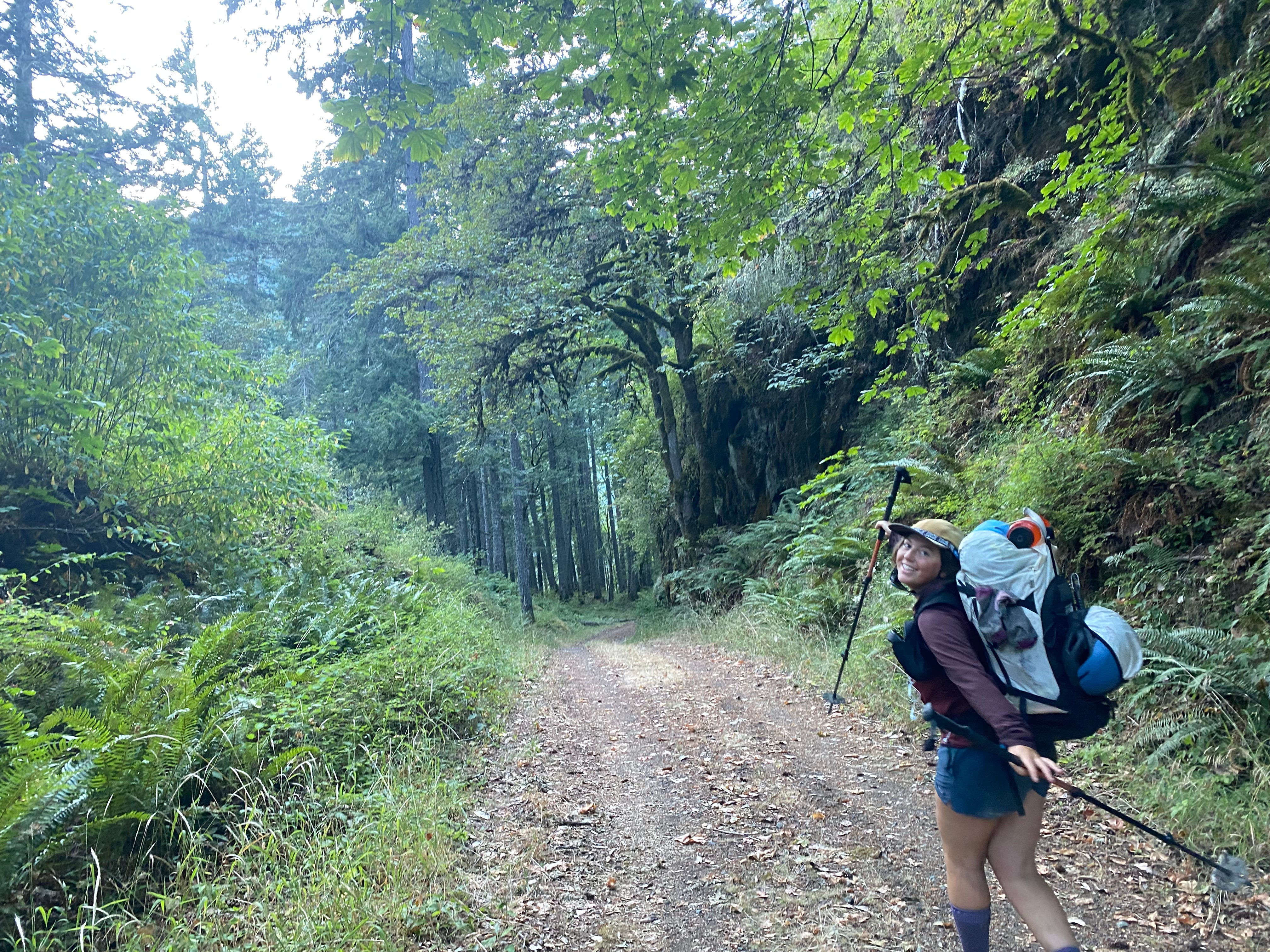
Unfortunately, I was not in Washington for most of the summer (instead, I spent June and July on the Juneau Icefield in Alaska as part of the Juneau Icefield Research Program). But upon returning to Seattle on August 5th, I spent a day packing and then immediately headed out to the Sol Duc trailhead the evening of the 6th with my friend Mimi to traverse the Bailey Range, with a 5-day itinerary in mind matching Climber Kyle’s.
Things did not go exactly to plan. We made it without incident to the toe of the Humes Glacier in 3 days, but steep blue ice, incoming thunderstorms, and a lack of ice screws made it unwise to continue on our planned route. Our primary exit strategy being blocked, we started to realize just how deep in the wilderness we were. The Elwha Snowfinger, the traditional exit route, is by all accounts no longer a viable late-season exit. This meant that our only way out short of completely retracing our steps was to exit out toward Dodger Point along the Ludden Peak way trail. And this is exactly what we did. After two very long days, we emerged early on our 6th day, unscathed but exhausted, at the Madison Falls Trailhead, ending our adventure.
A statistic I had heard tossed around before completing this trip (and which park rangers supposedly use to dissuade unqualified parties from acquiring permits) is that several years ago, 1 in 5 parties who attempted the Baileys had to be rescued by helicopter. Before the trip, reading successful trip reports on the internet, I had a hard time comprehending how this statistic could possibly be true; I mean, the route is on CalTopo and “rarely exceeds class 2”! However, having now completed the traverse, I buy this statistic, and I would like to emphasize from the start that the Bailey Range Traverse is a very serious and committing undertaking that should only be attempted by experienced backcountry travelers. As a 21-year-old with strong routefinding and backcountry living skills but with limited experience traveling unguided over this level of rugged terrain, I was definitely pushing the boundaries of my comfort zone. I was prepared, but just barely.
Disclaimers aside, the traverse is exceptionally beautiful, and the adventure was absolutely a highlight of my life in the outdoors thus far. Here is my honest experience in the Bailey Range this summer:
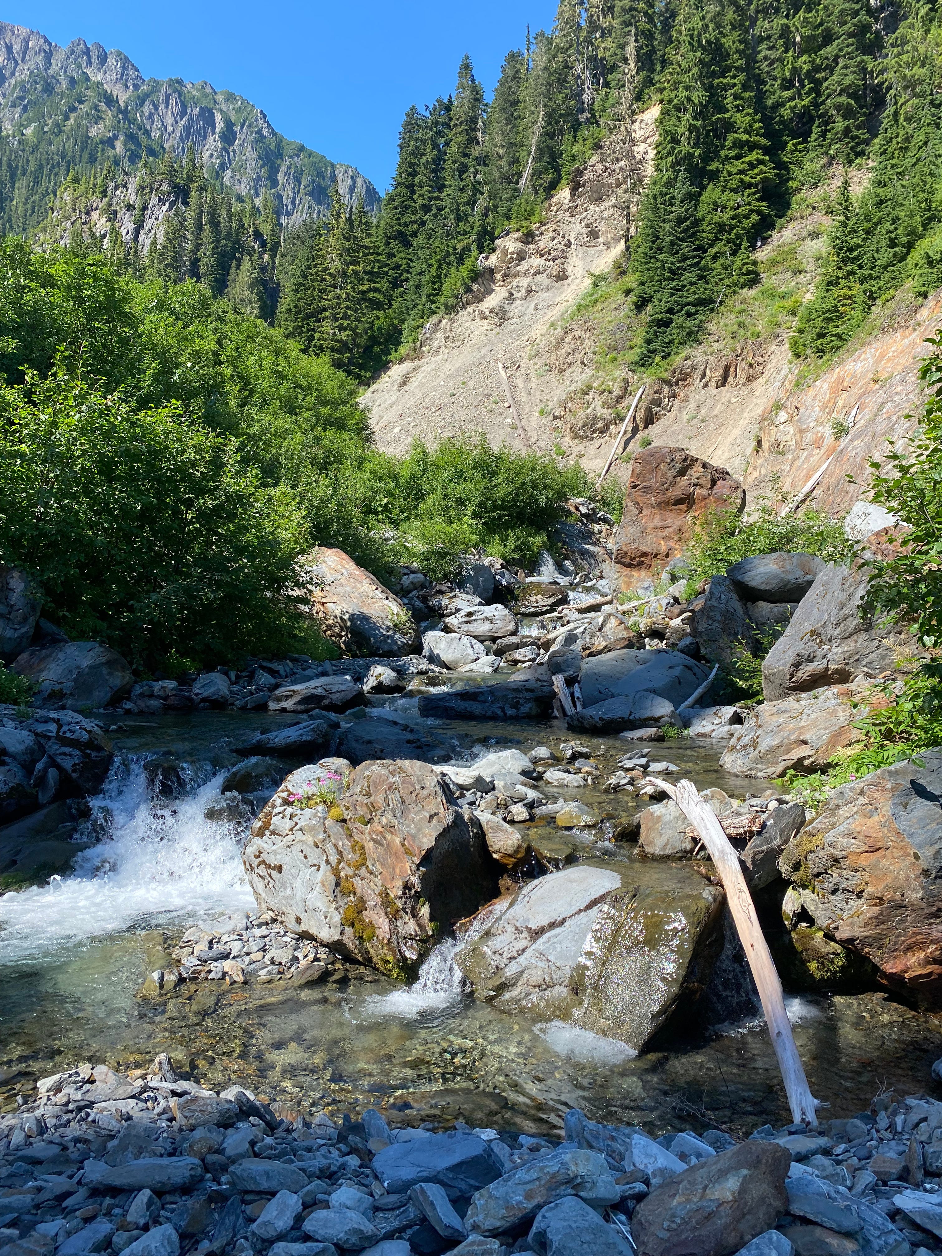
Day 1: Sol Duc to Eleven Bull Basin
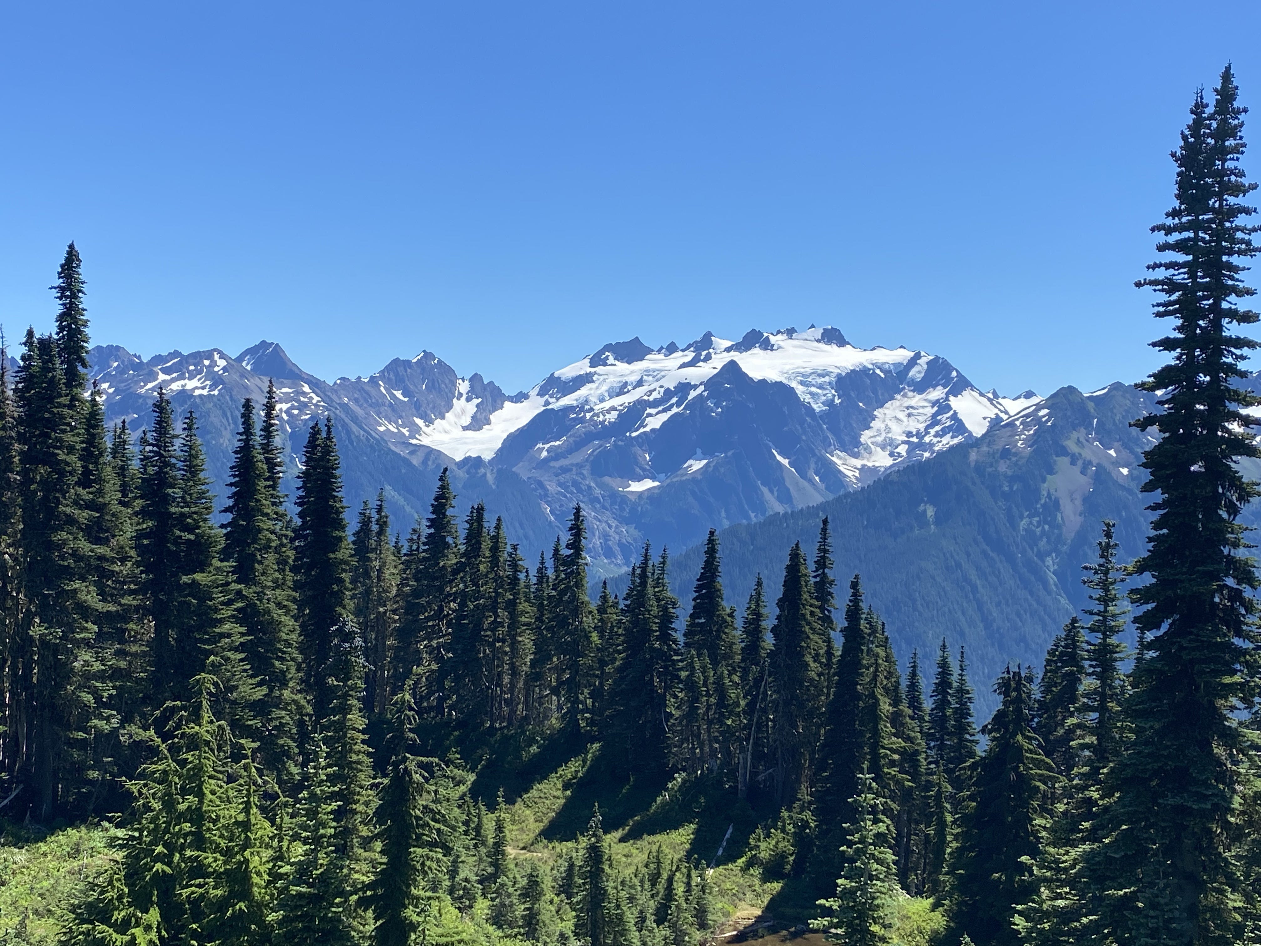
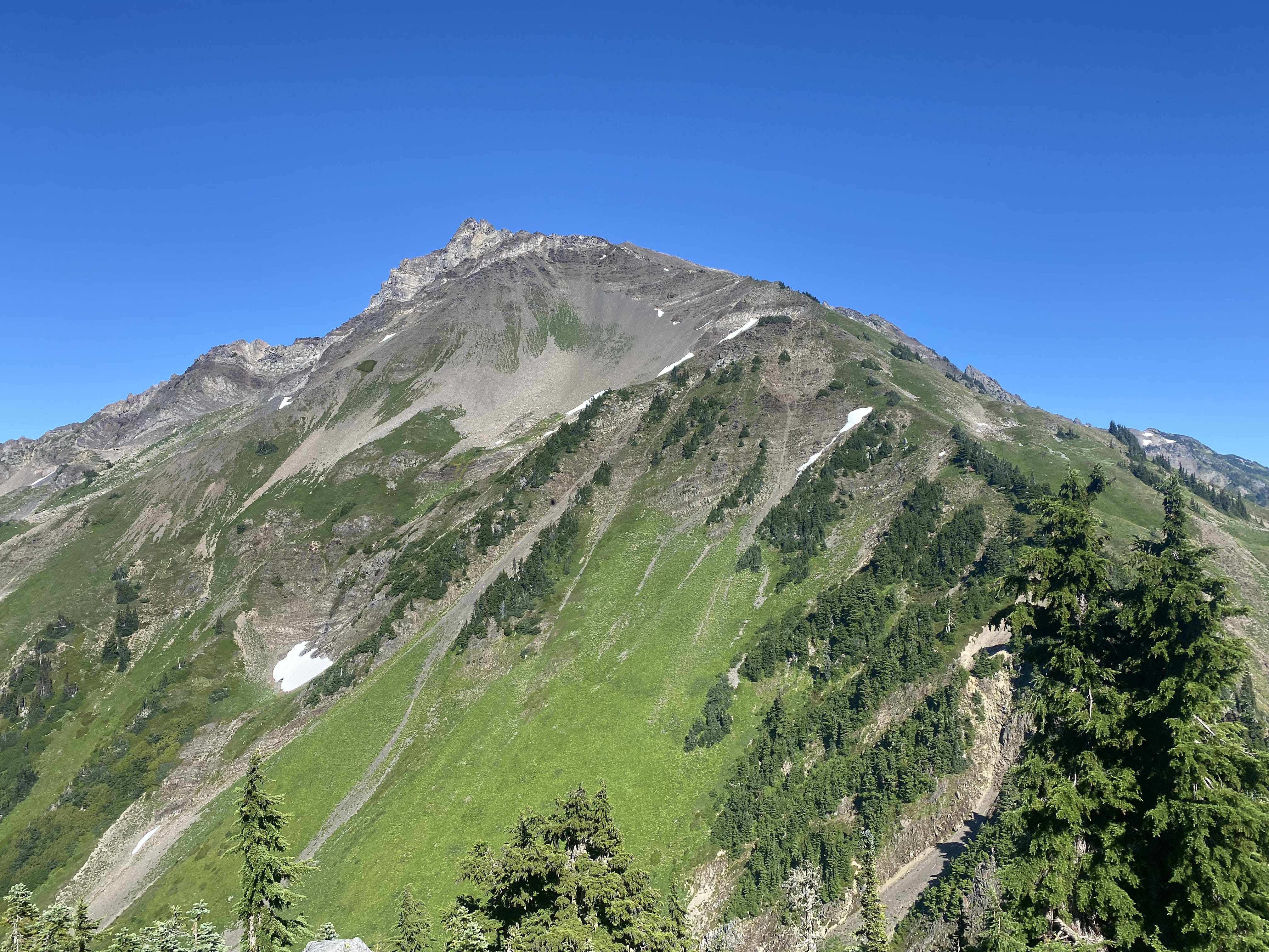
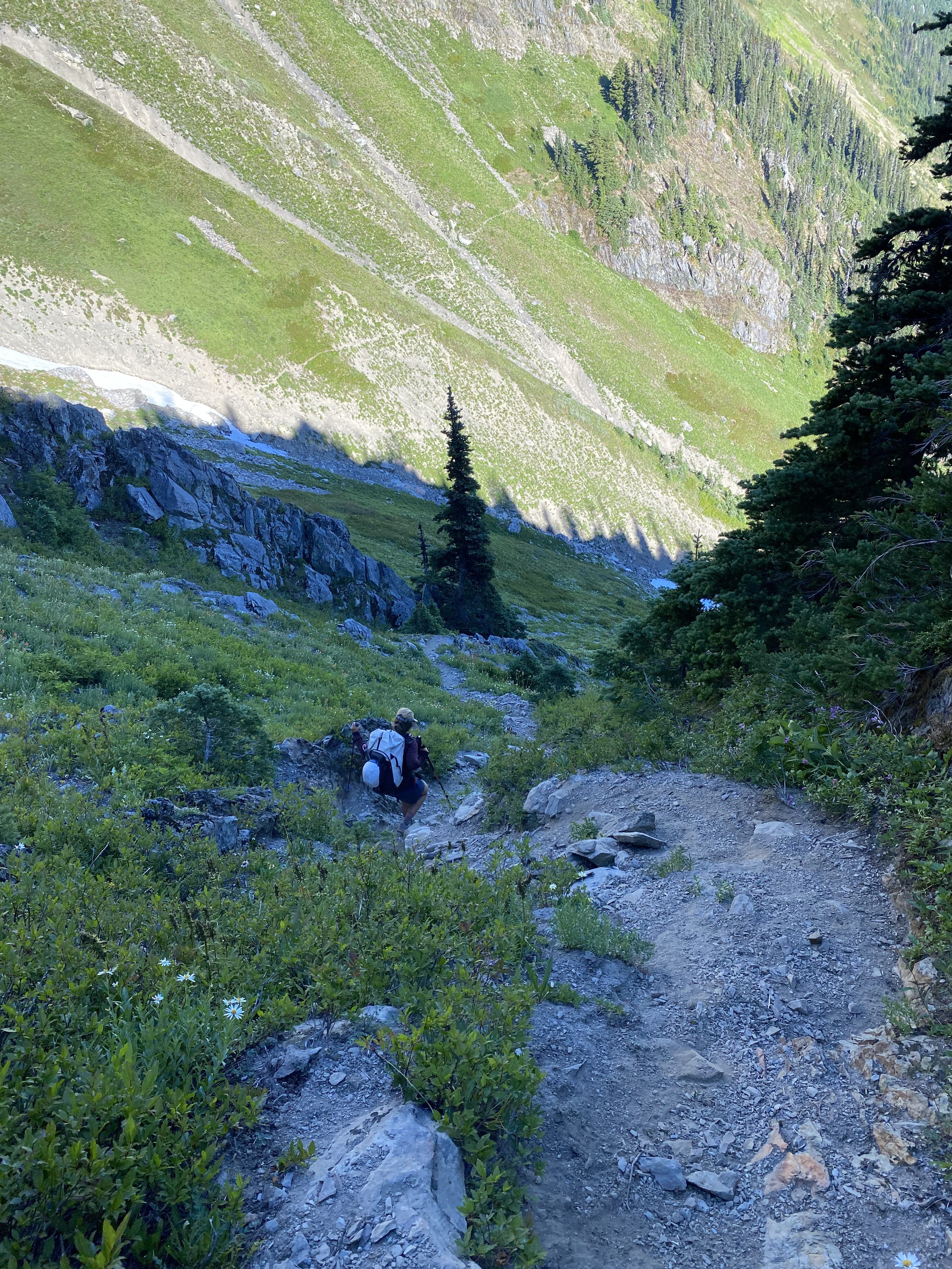
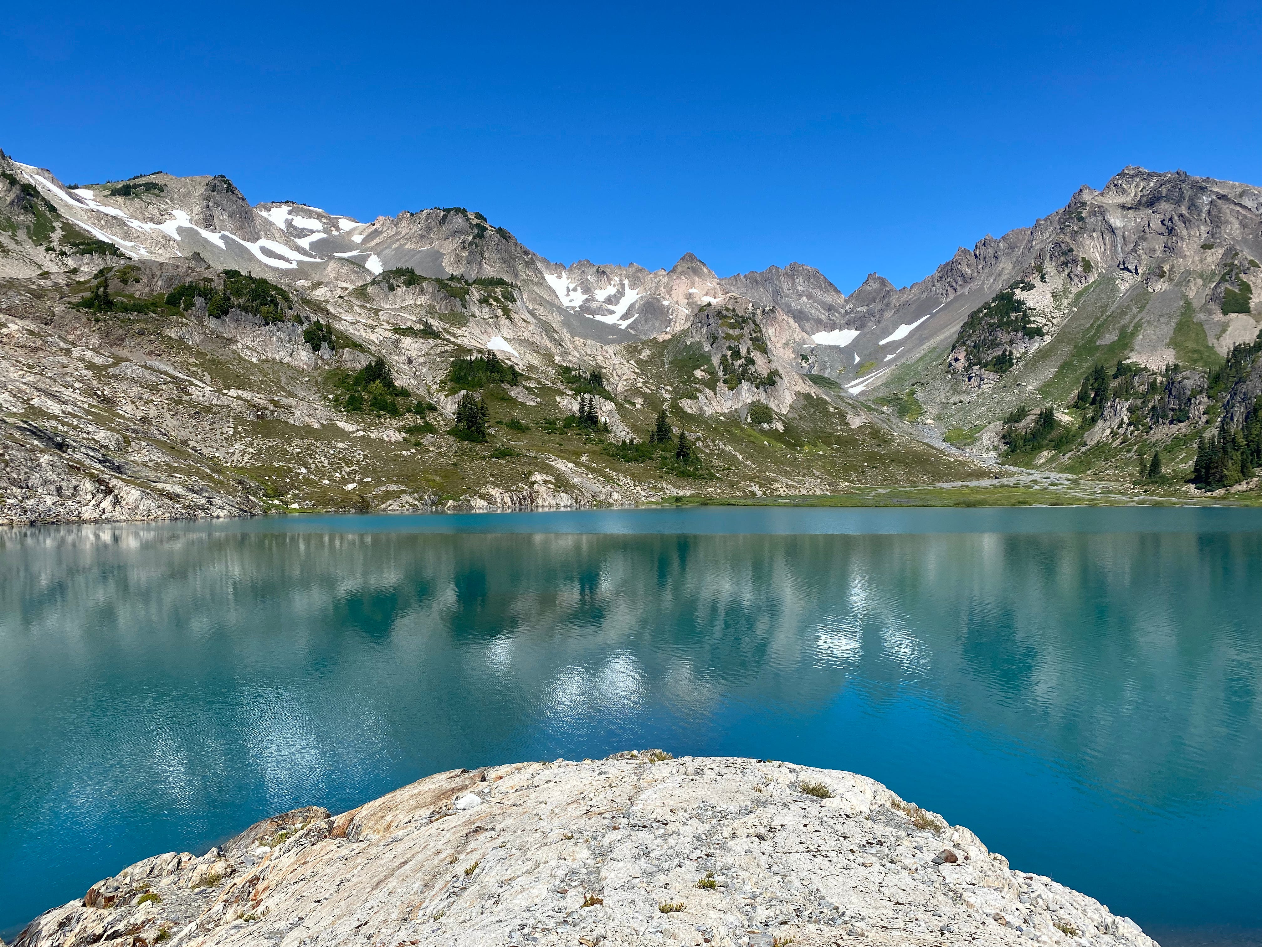
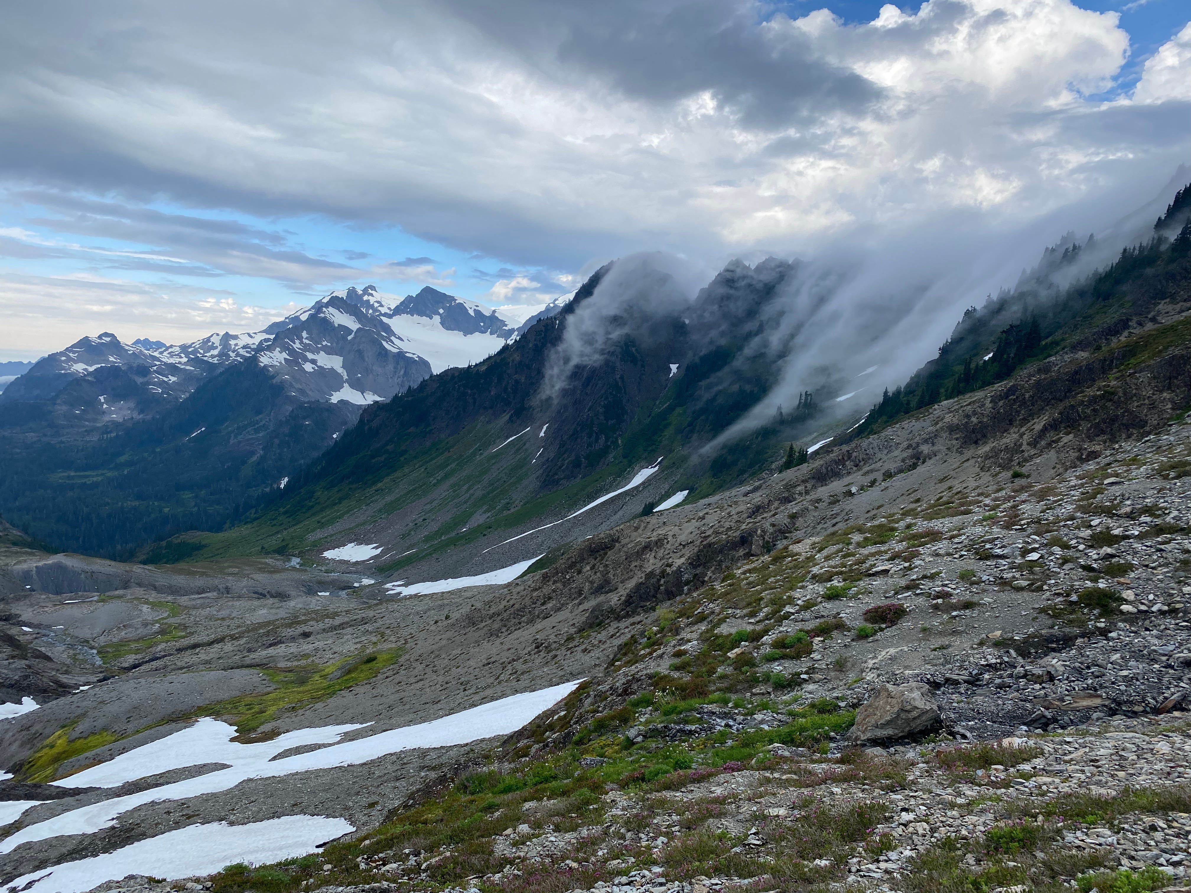
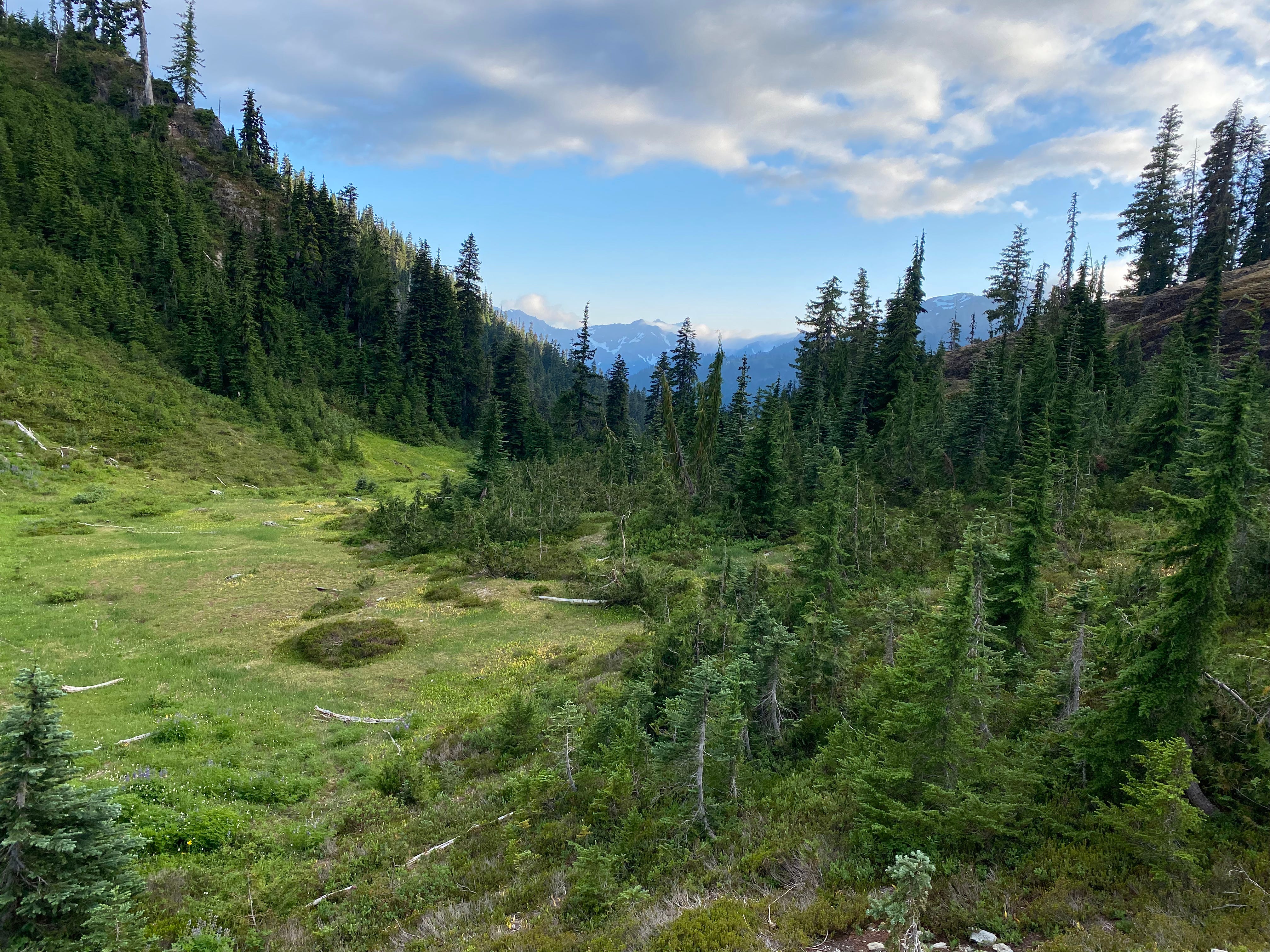
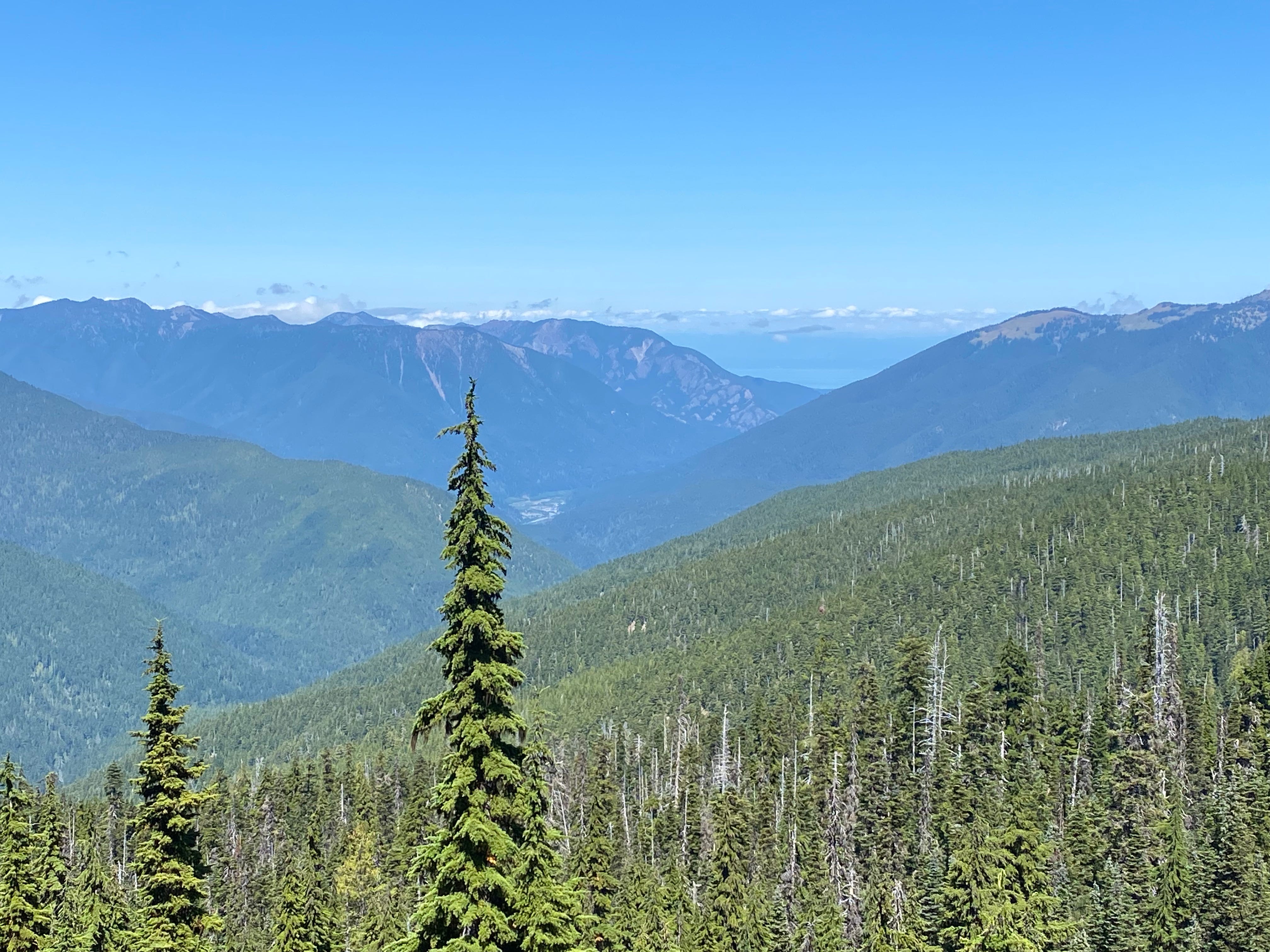
Our first day generally went quite smoothly. We opted to climb to the High Divide via Deer Lake, to maximize the ridge walking and views of Olympus. It was a perfectly sunny day, although quite hot. As expected, the views were stunning:
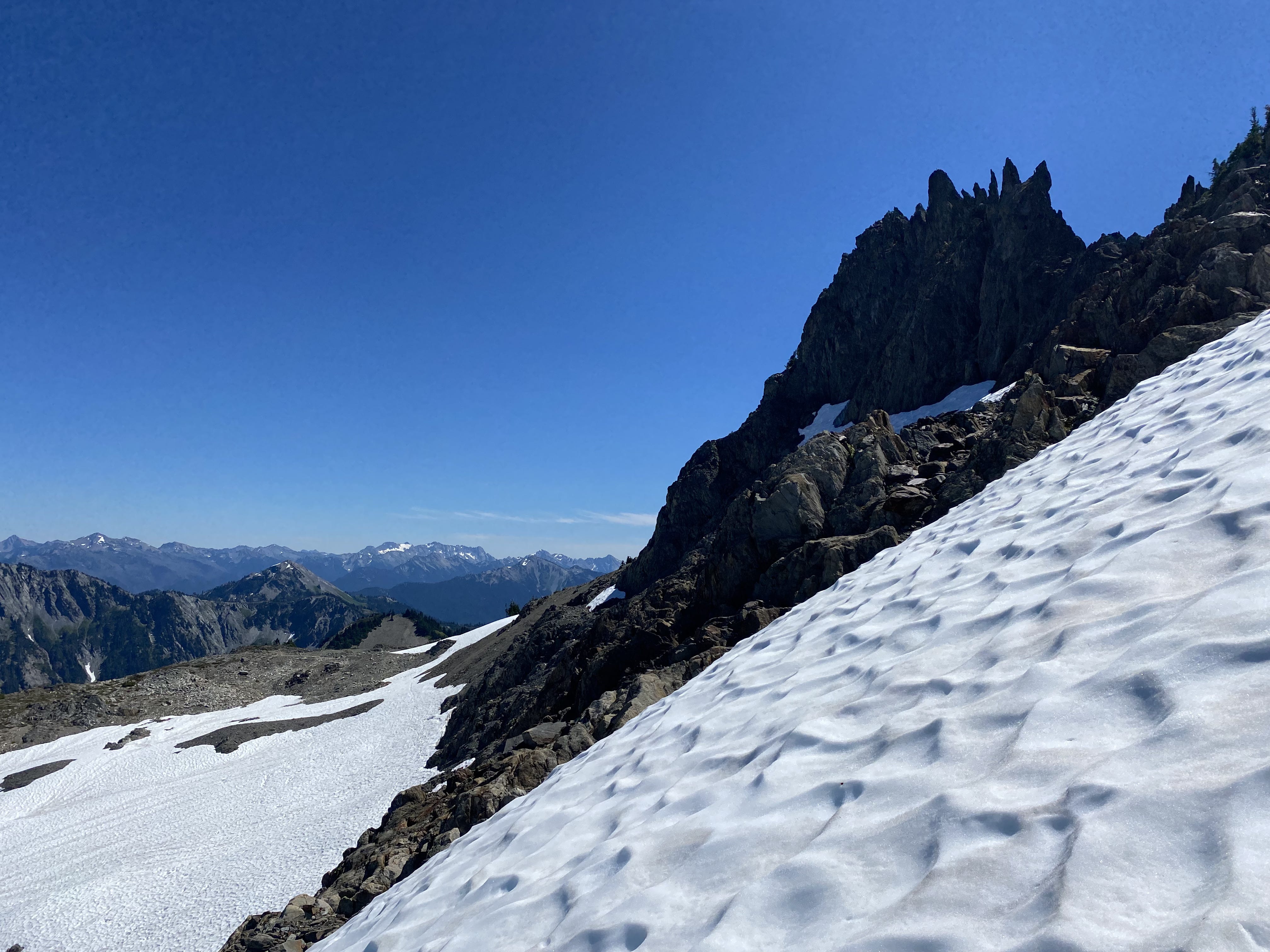
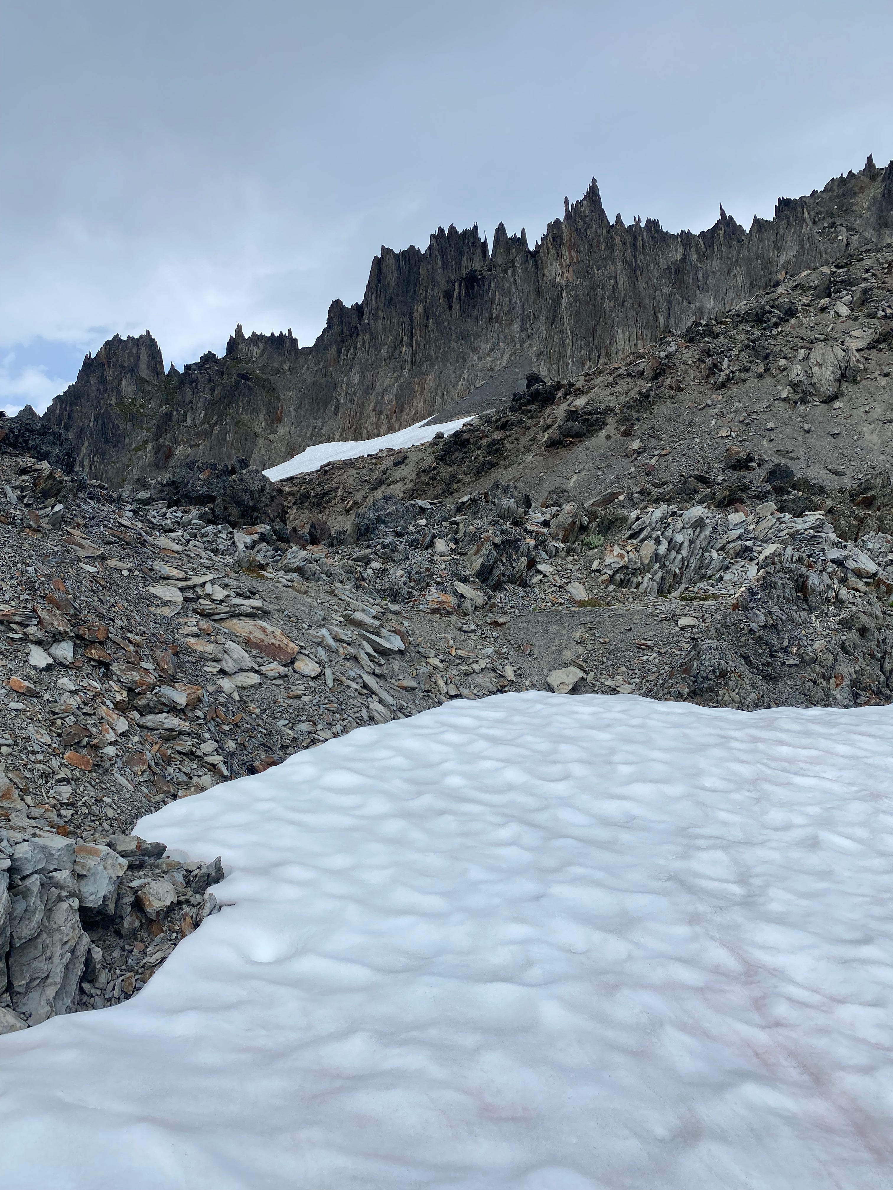
Until the catwalk (the saddle between Cat Peak and Mount Carrie), the trail is very well-maintained. We ran into one party below Cat Peak that had just completed the Baileys in the other direction. In hindsight, I wish we had asked them more questions about their route; these would the last people we’d see for quite some time!
Upon reaching the catwalk, however, the trail immediately deteriorates in quality, quickly climbing 200 feet, losing 200 feet, then crossing the catwalk itself. On the bright side, at this point we got our first clear views of the ocean!
My thoughts on the catwalk: generally, this section involved making class 2 and class 3 moves on very solid rock, often with trees around for extra security. The only section that I remember being scary in hindsight was one short, loose, exposed section near the end. Go slow and you should be fine. Actually, I think the catwalk serves as a decent barometer for whether the Bailey Range is for you: if you’re comfortable navigating this type of terrain, then you should be able to handle everything coming your way on the rest of the traverse (assuming you stay on route); if not, then it may be time to turn around.
On the Mount Carrie side, the trail starts up again, well-tread enough that it’s always clear where to go, but significantly more sidehill-y than on the Cat Peak side. We found a small pool of stagnant water directly after the catwalk, but note that other than that, we found no water between the High Divide and Eleven Bull Basin.
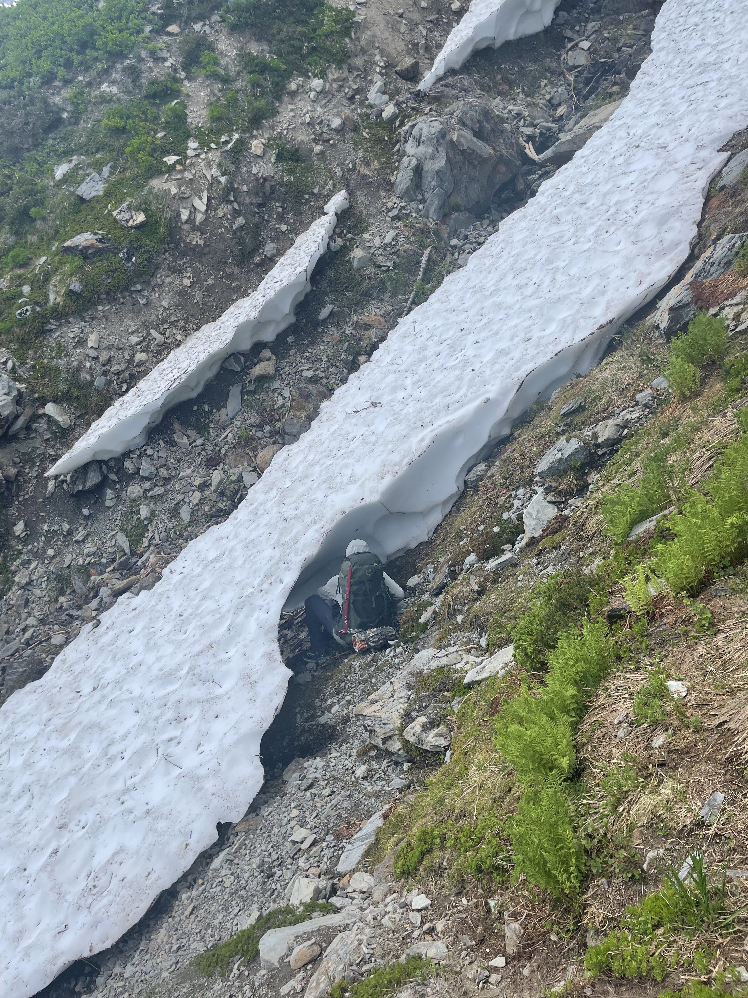
This section navigates a number of steep, loose gullies, which were sometimes tricky to cross. Even outside of the gullies, the hillside was quite steep, and travel was pretty slow. Regardless, within an hour and a half of crossing the catwalk, we had arrived at Eleven Bull Basin, a gorgeous meadow with a stream running through where the hillside finally flattens out. Needless to say, we had the camp to ourselves.
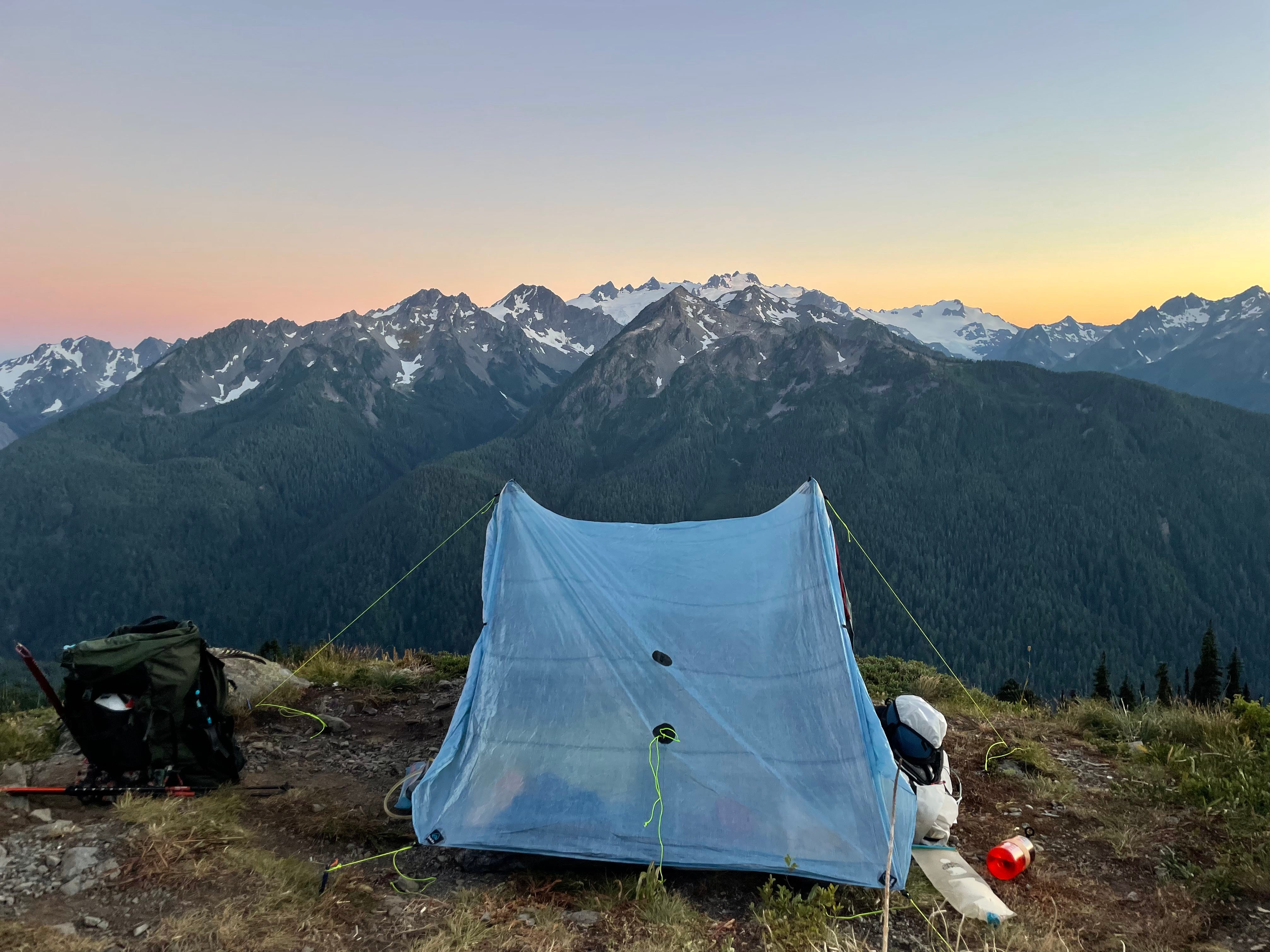
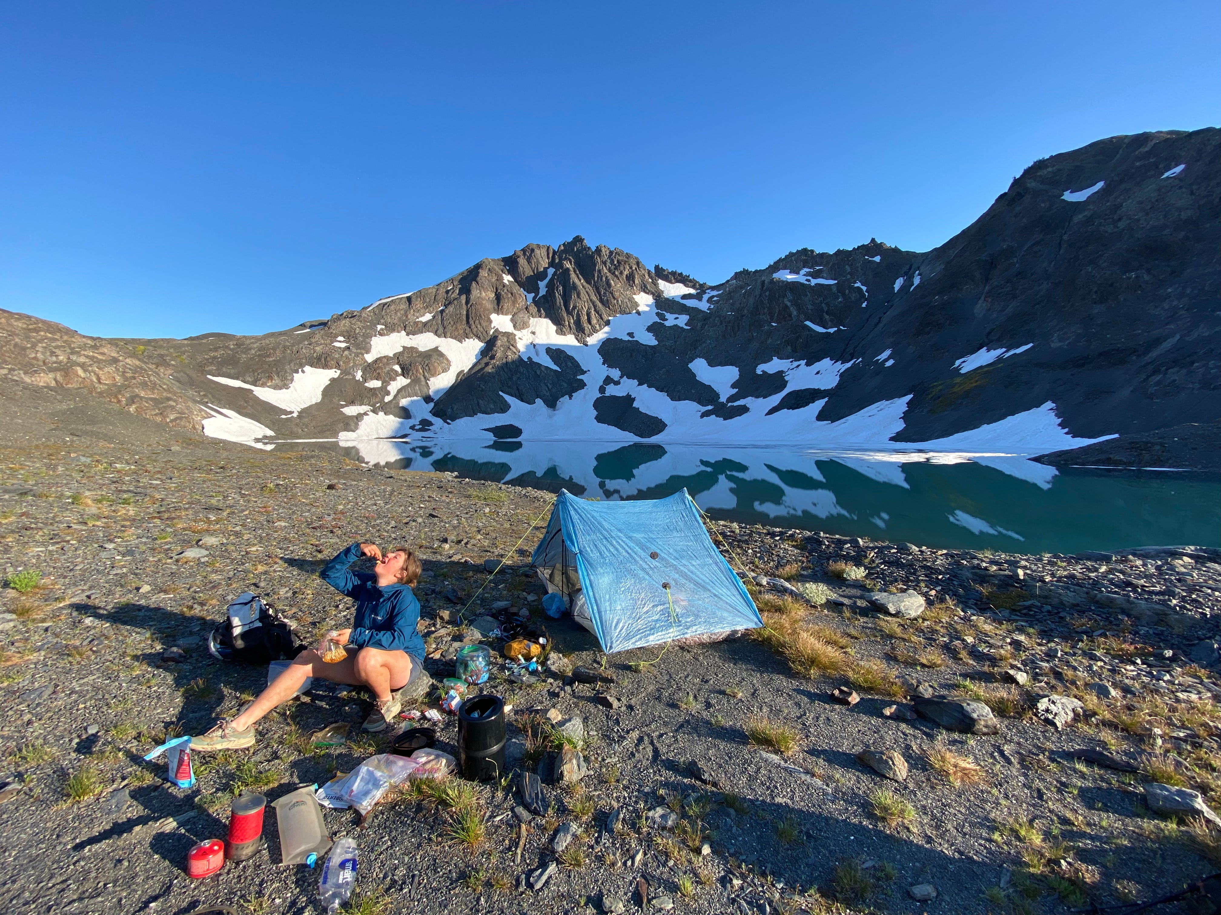
Although the day had mostly been on well-maintained trail, we had still gained nearly 6000 feet of elevation and walked 15 miles. With packs that were still nearly 45 pounds at this point, this was a big day, and we were glad to finally reach our destination for the night. The sunset was gorgeous. It felt good to lie down.
Day 2: Eleven Bull Basin to Ferry Glacial Lake
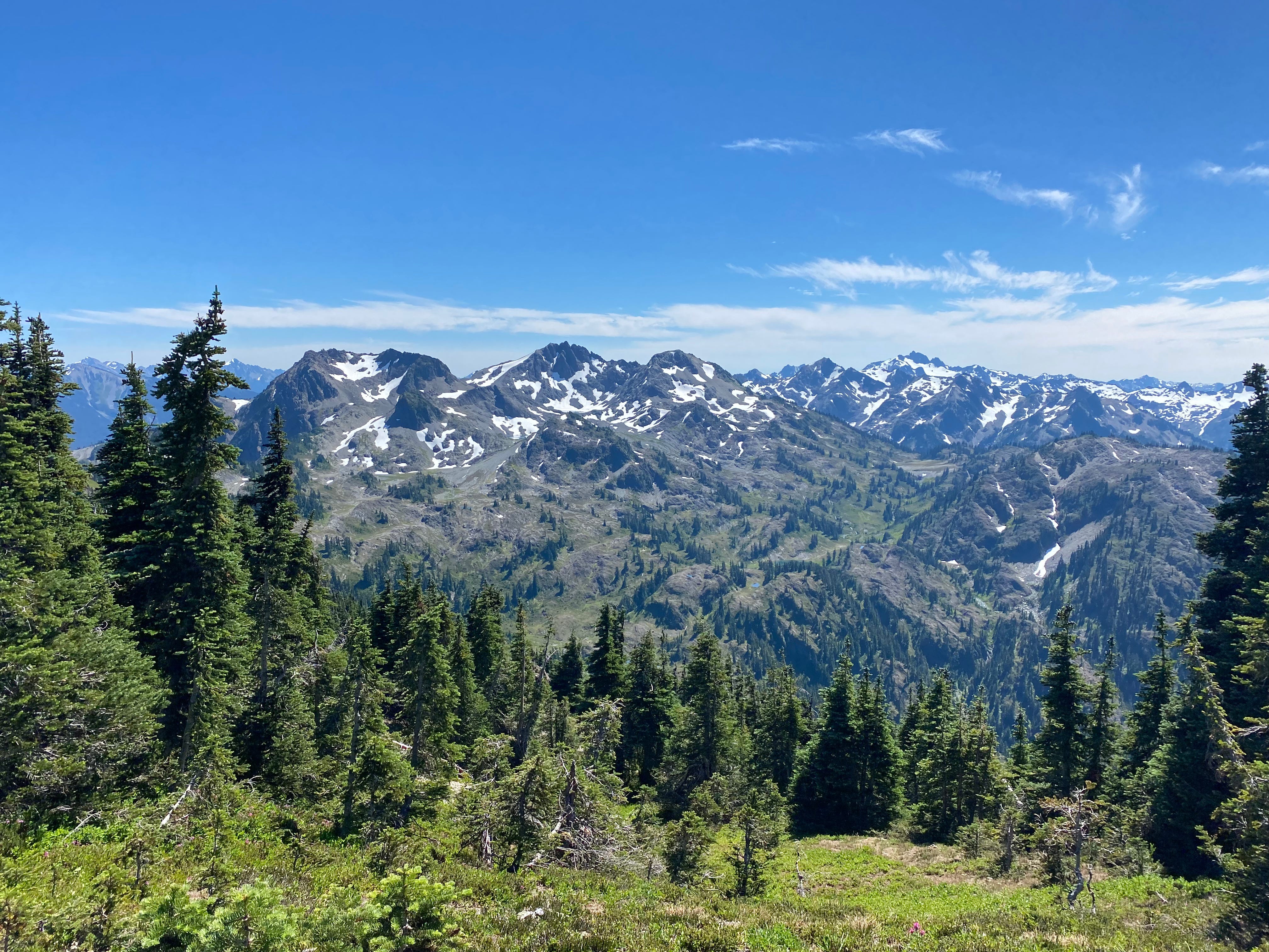
Day 2 started up as the previous day had ended: steep sidehilling and gully crossing in the shadows of Mount Carrie and Ruth Peak. Although the original Bailey Range traverse continues sidehilling all the way until Cream Lake, I couldn’t find a single trip report on the internet that has actually taken this route (some trip reports even warn against doing this!), so the decision was easy to reroute to Stephen Lake Basin. In any case, it was extremely pretty.
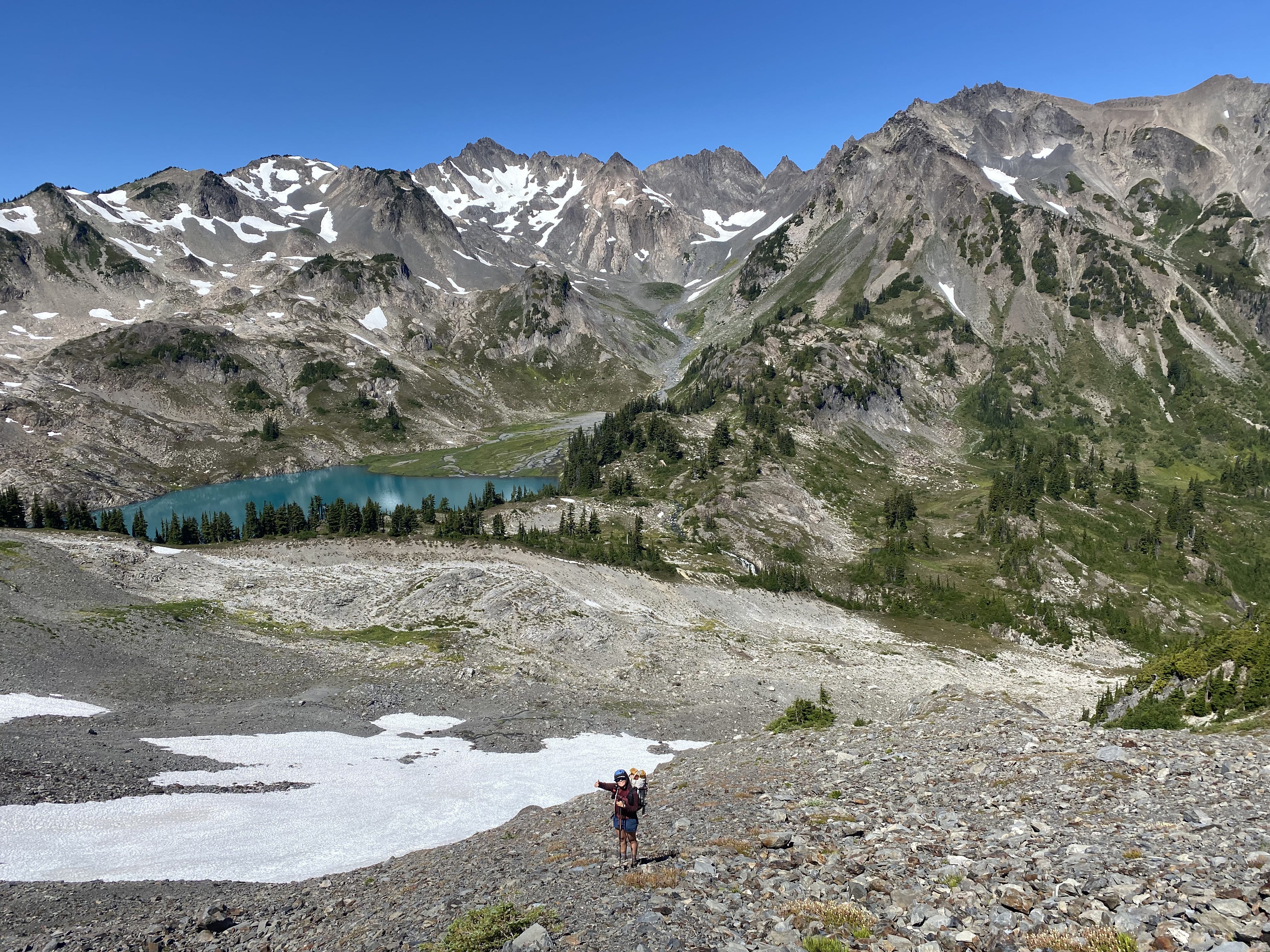
We couldn’t find a trail climbing up from the main Bailey Range trail to the saddle above Stephen Lake, but the slope was sufficiently low-angle that it was completely straightforward to walk uphill without one. Descending into Stephen Lake Basin was similarly straightforward; the terrain on this side of the Hoh-Elwha crest was much mellower, at least for the time being. We went around the lake to the right in the above picture.
After stopping briefly at Stephen Lake for a swim, it was time to climb again. We followed the southern of the two unmaintained trails marked in Gaia’s satellite topo layer out of the basin. Although it was only a 1200 foot climb, it felt really large, ascending directly up a mixture of snowfields and scree fields to right below the summit of Stephen Peak.
At the top, we briefly attempted to scramble to the summit of Stephen Peak, but turned around because the moves on our (probably wrong) route to the summit were class 4 and we didn’t feel like taking unnecessary risk. This was the highest elevation we reached on the traverse.
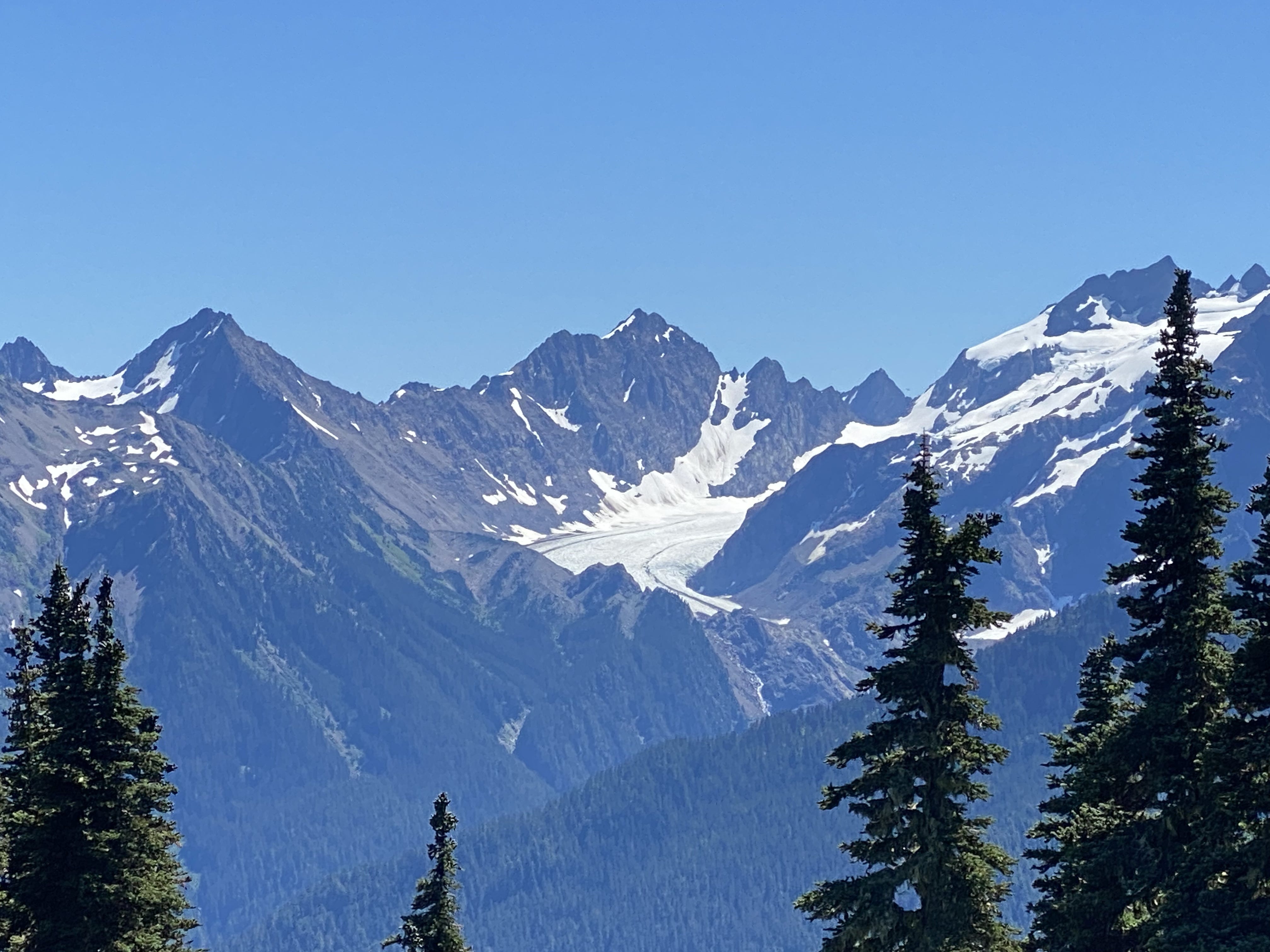
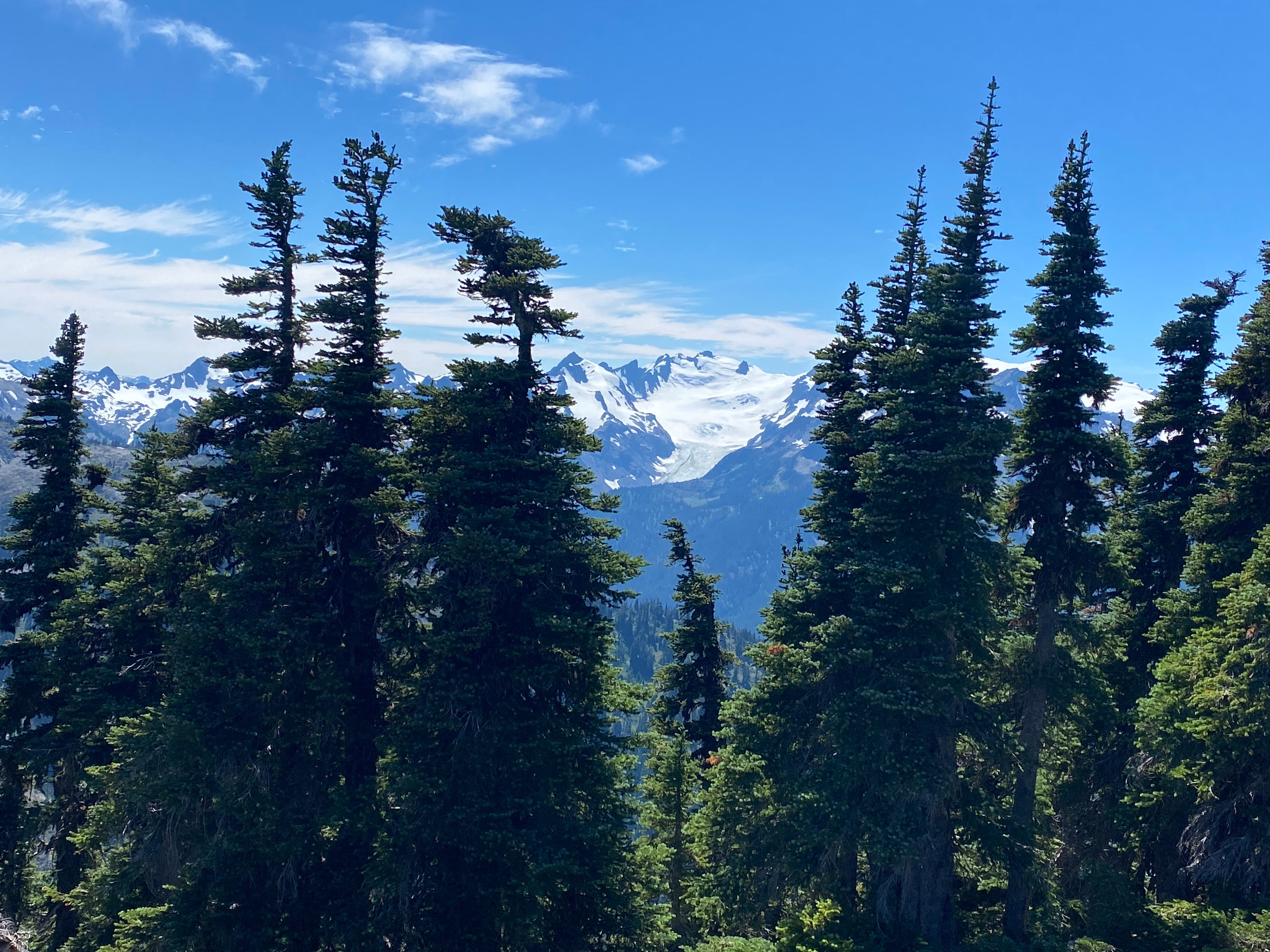
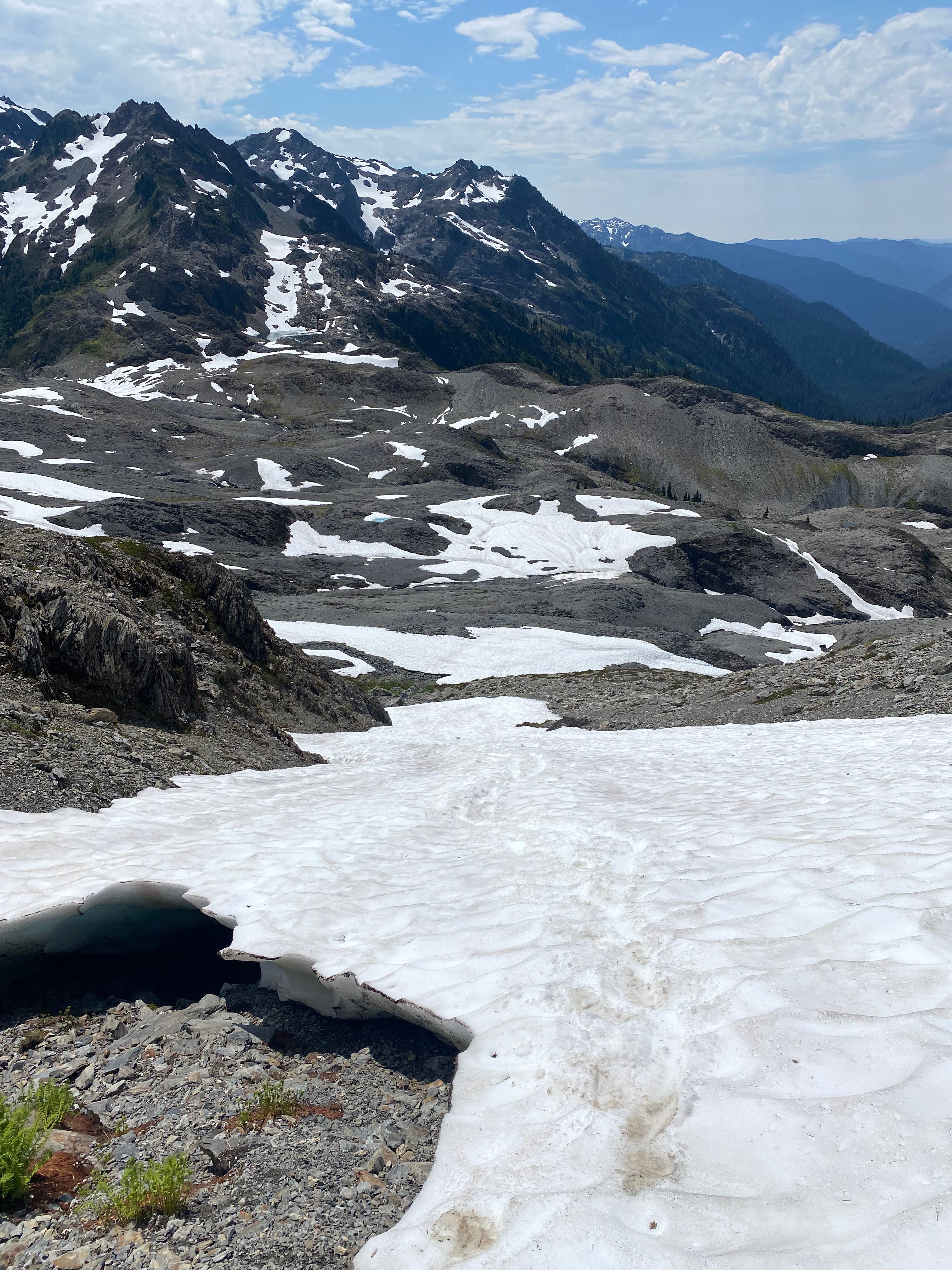
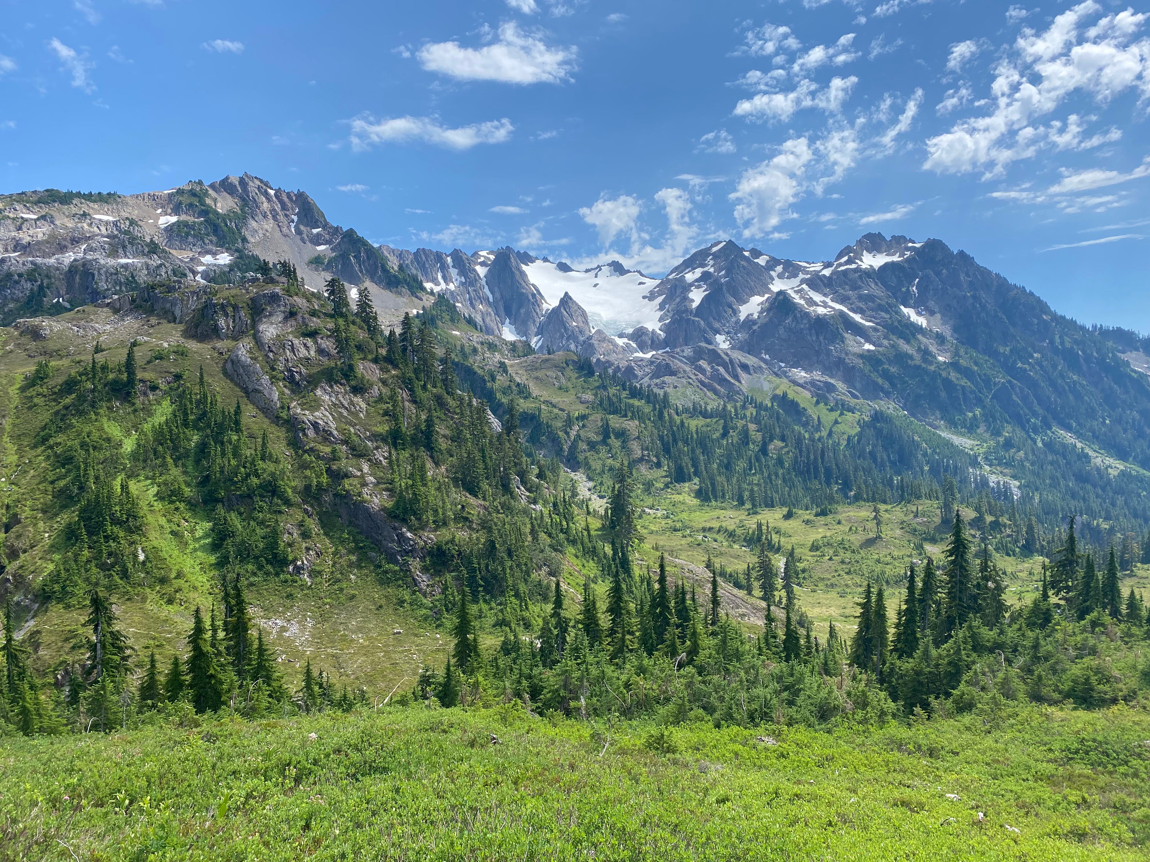
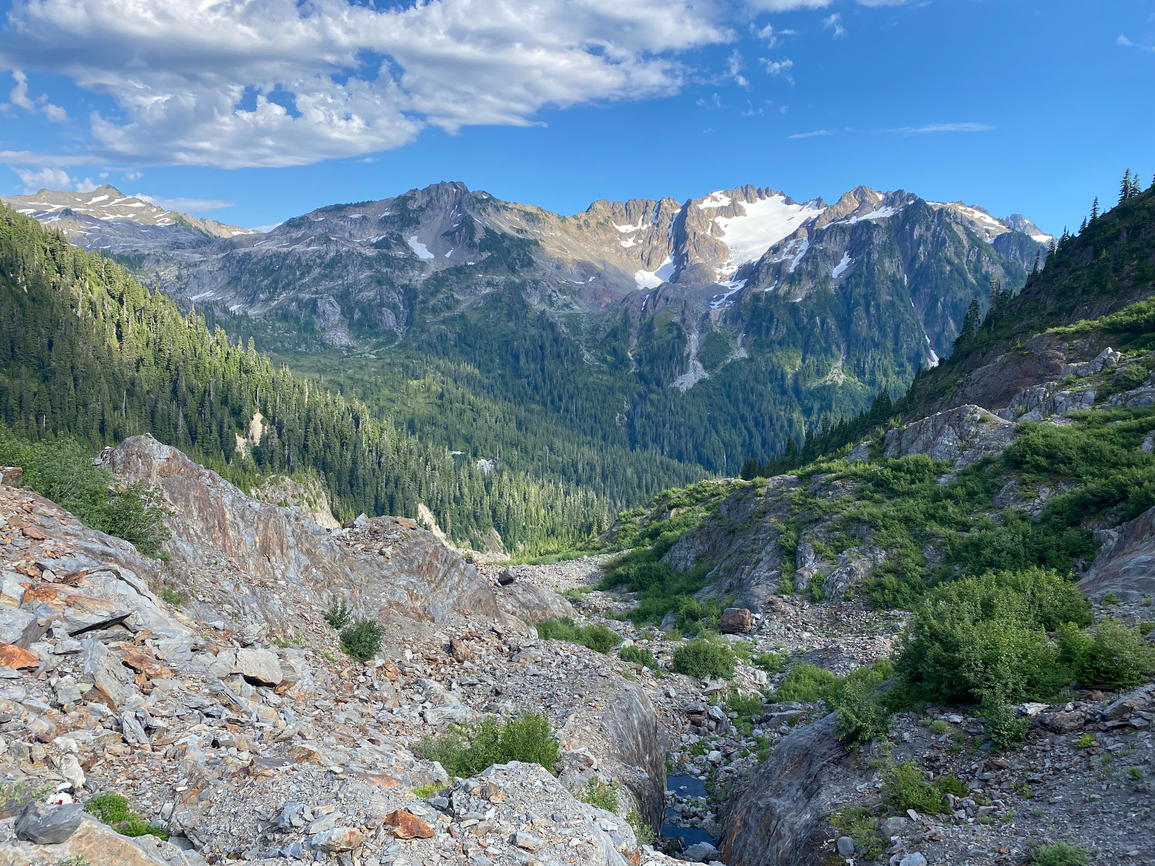
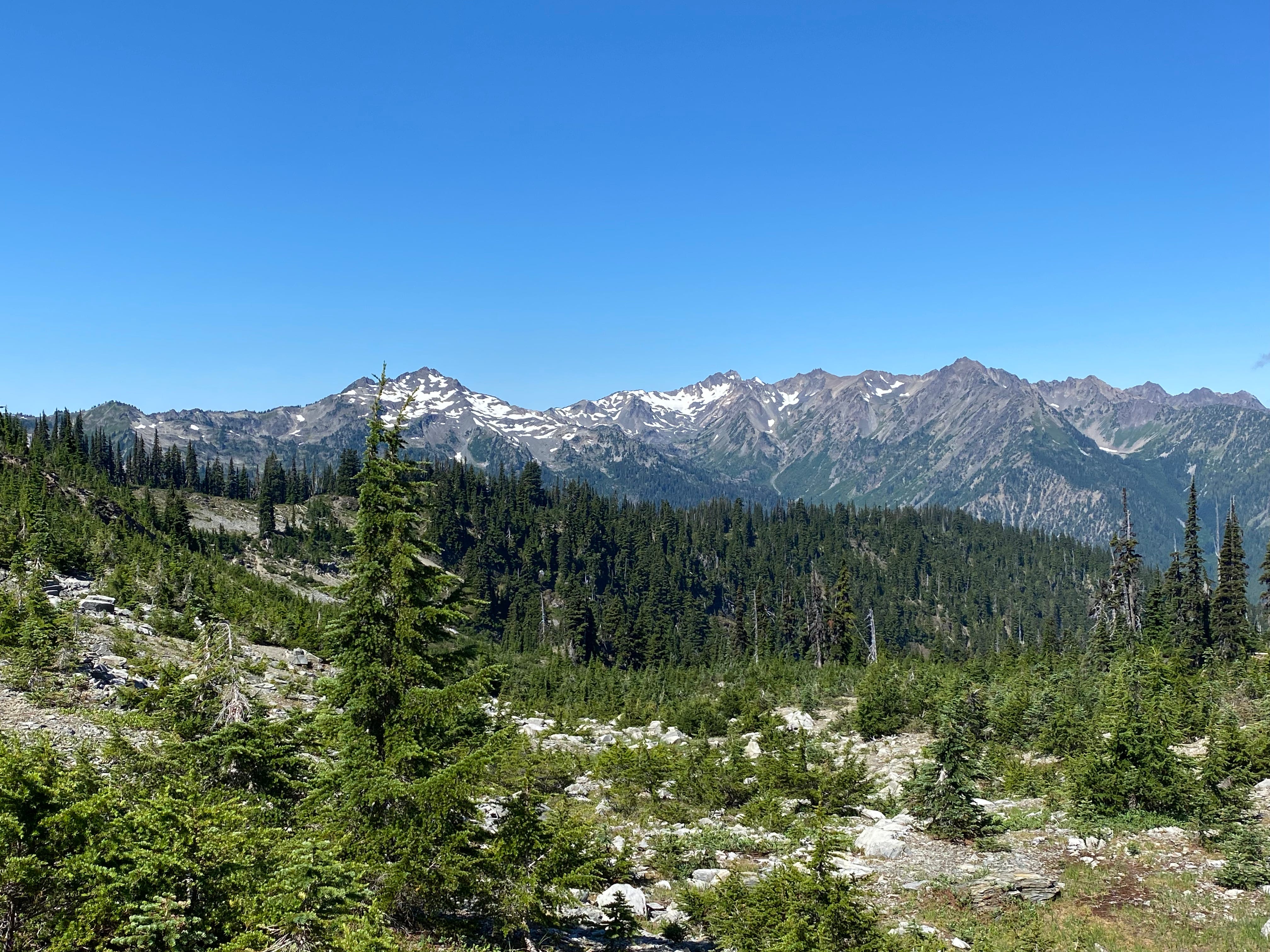
From here, we descended, following footprints in the snow to treeline, then meandering along a very pleasant snow-free ridge above Ferry Basin. At this point, the Hoh Glacier also came into view.
Despite the mellow ridge, we still managed to lose the trail repeatedly during this section. In hindsight, my advice would be to stay on the ridge until you can descend directly into upper Ferry Basin, even though Gaia shows a trail that supposedly traverses the sidehill 200 feet below the ridge.
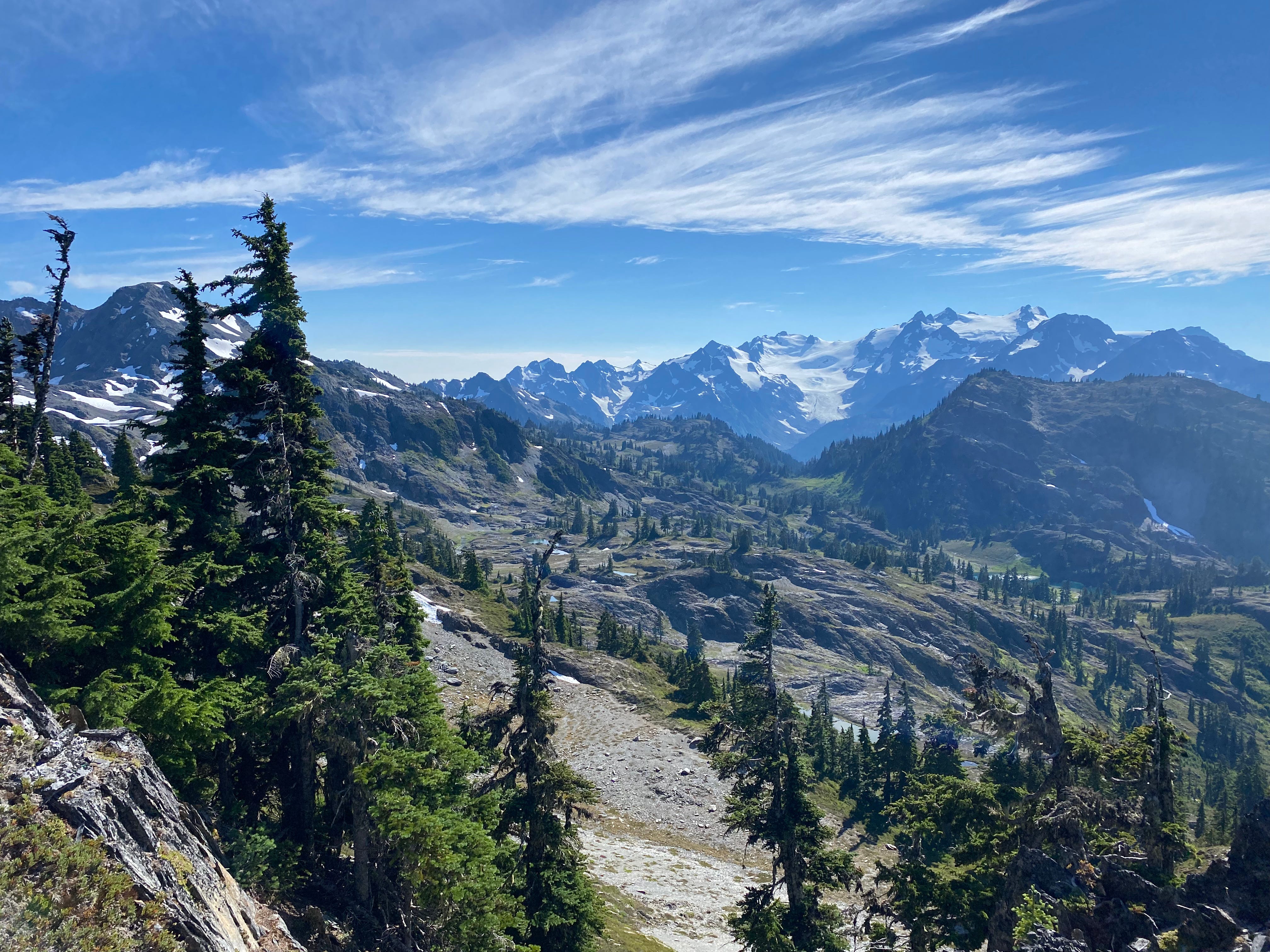
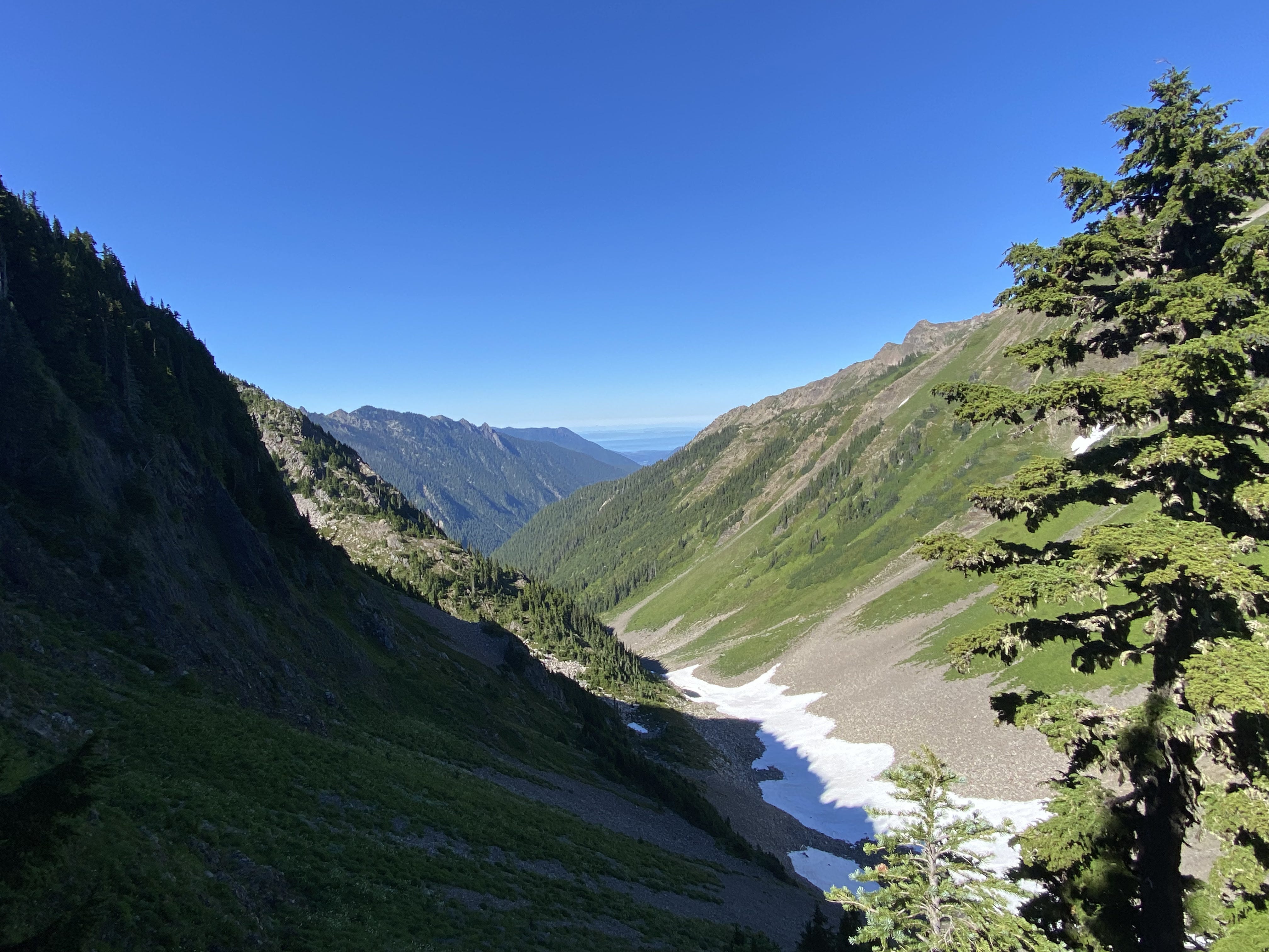
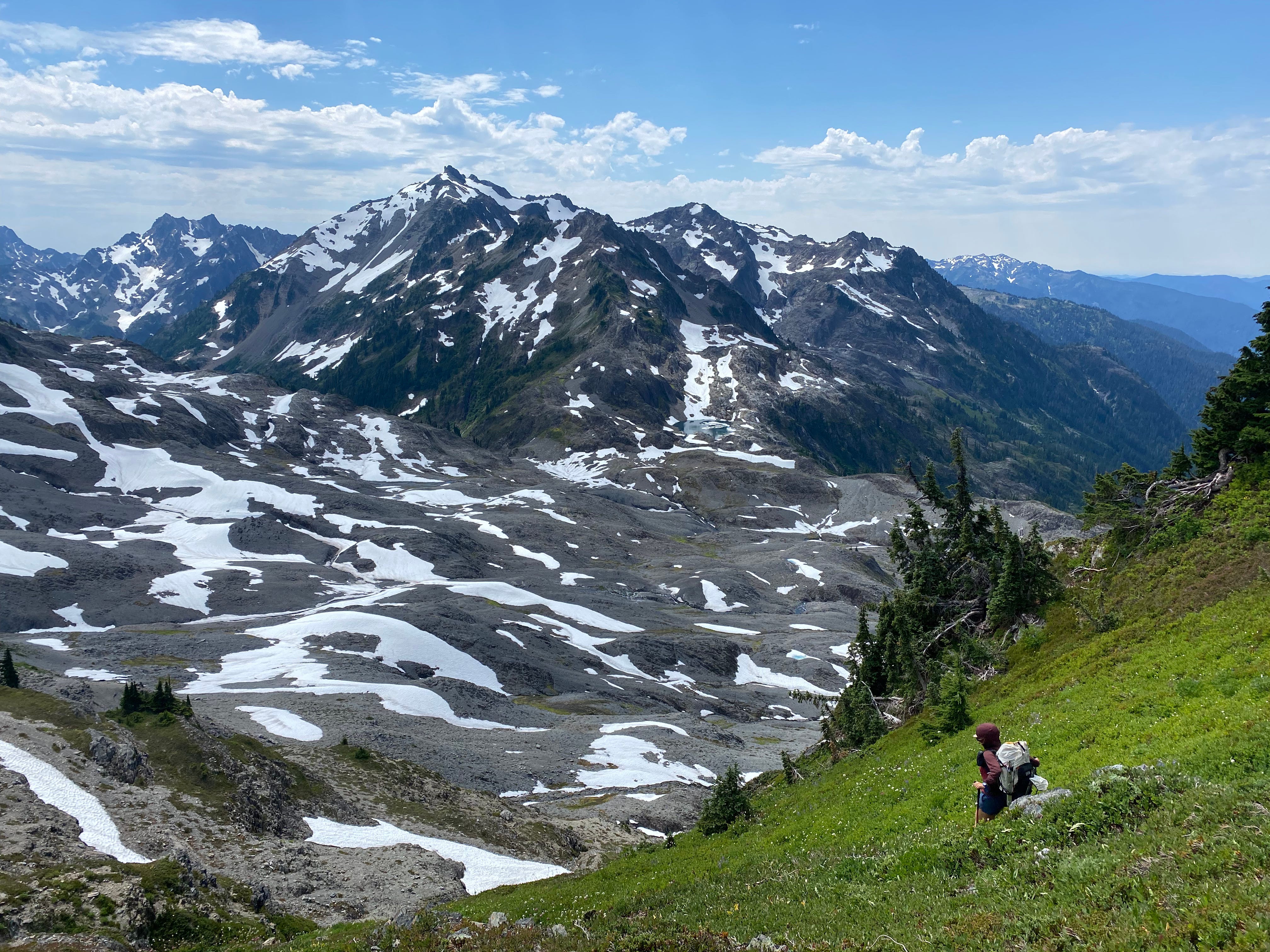
At this point, the terrain transitioned from what I would describe as “annoyingly postglacial” to what I would describe as “pleasantly postglacial.” The terrain became mellower; the scree became nicer to walk on. The terrain from Ferry Basin to Queets Basin was as “cruiser” as it gets in the Bailey Range.
We quickly crossed Ferry Basin, then ascended to Ferry Glacial Lake (the upper of the two lakes beneath Mount Ferry). We had originally planned to go a bit further, but it was getting late in the afternoon and this was a very pretty campsite, so we stopped here for the night.
Day 3: Ferry Glacial Lake to Humes Glacier
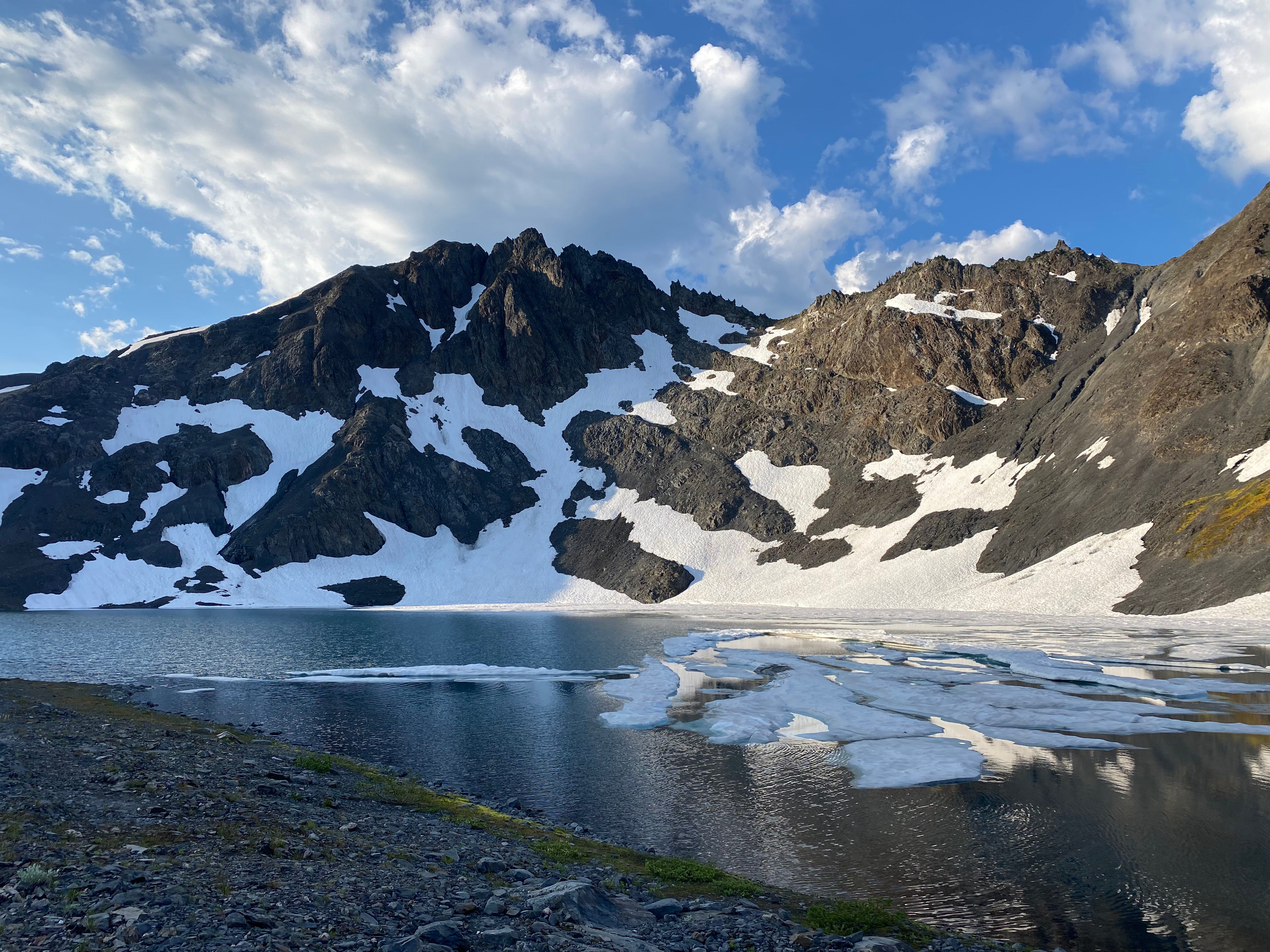
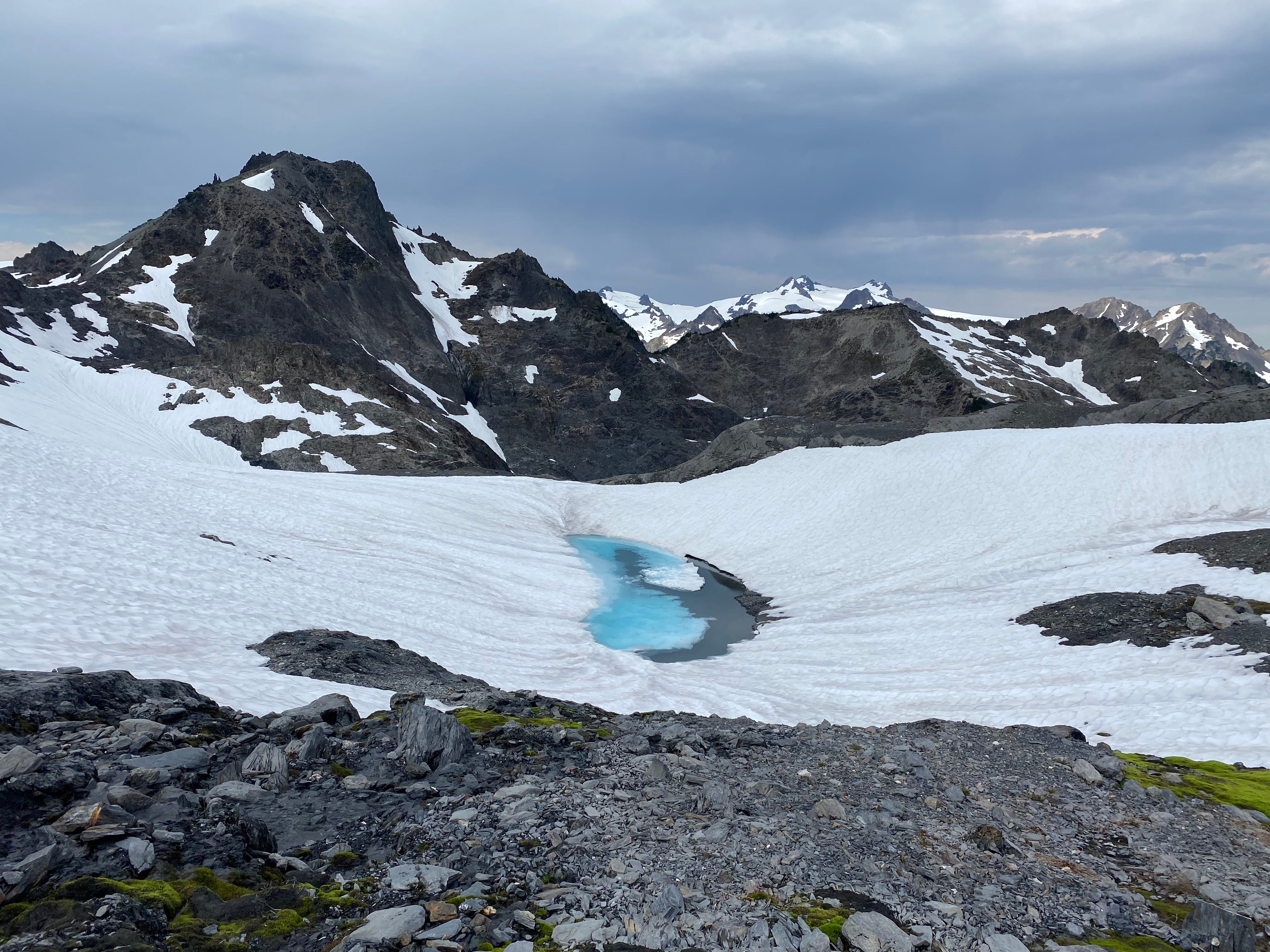
We had been doubtful that Ferry Glacial Lake was truly glacially fed anymore, since the snowfields on the other side showed no real signs of being glaciers. But the next morning, we woke up to find a bunch of new ice floating in the lake that hadn’t been there the night before (it also most certainly did not go below freezing overnight). I’m not quite sure what happened here, but I think this observation does imply that there must be some glacier ice under that snow on the other side of the lake.
Glaciological observations aside, we packed up that morning like any other, and continued past Lone Tree Pass into the southern Baileys.
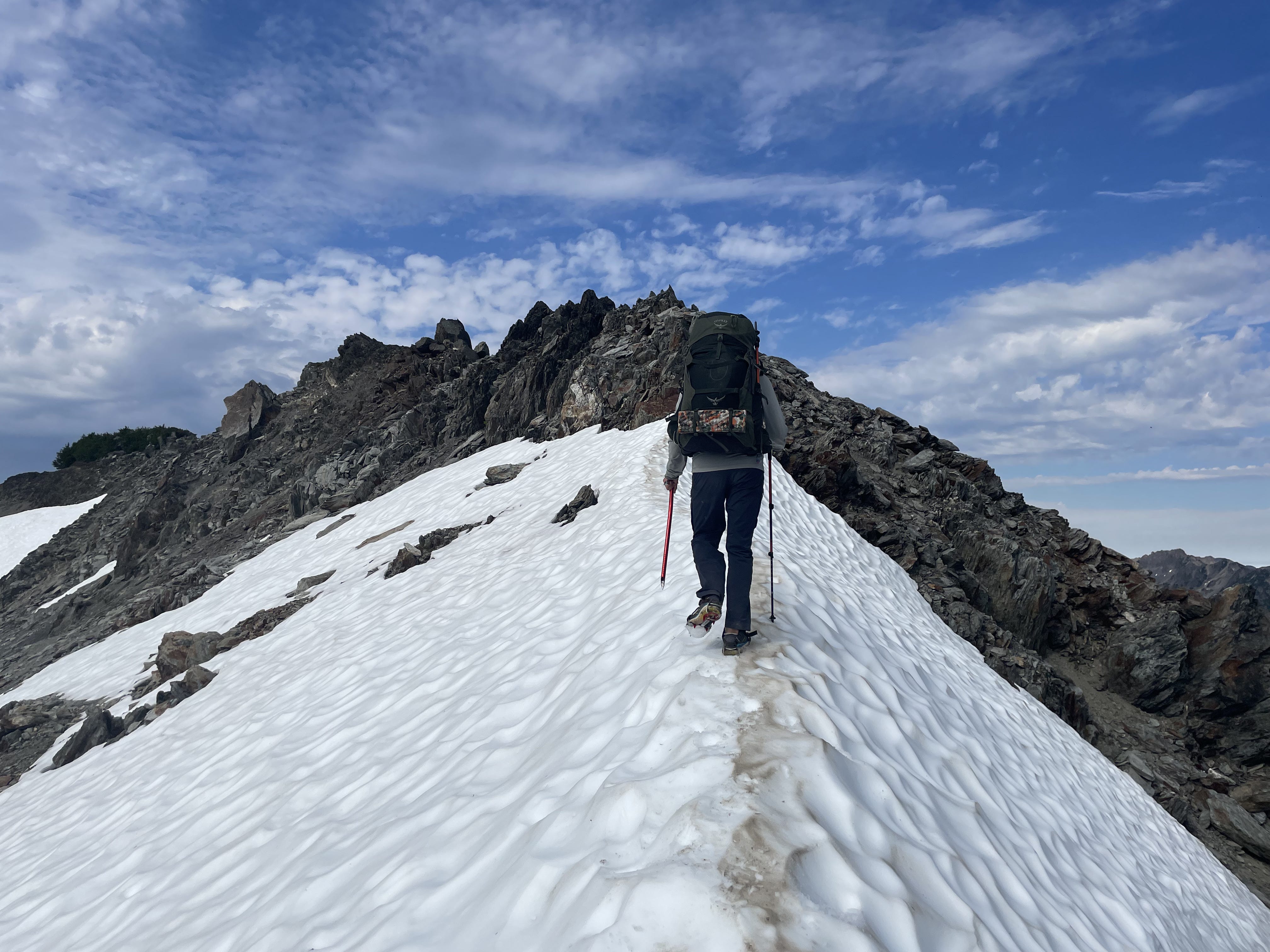
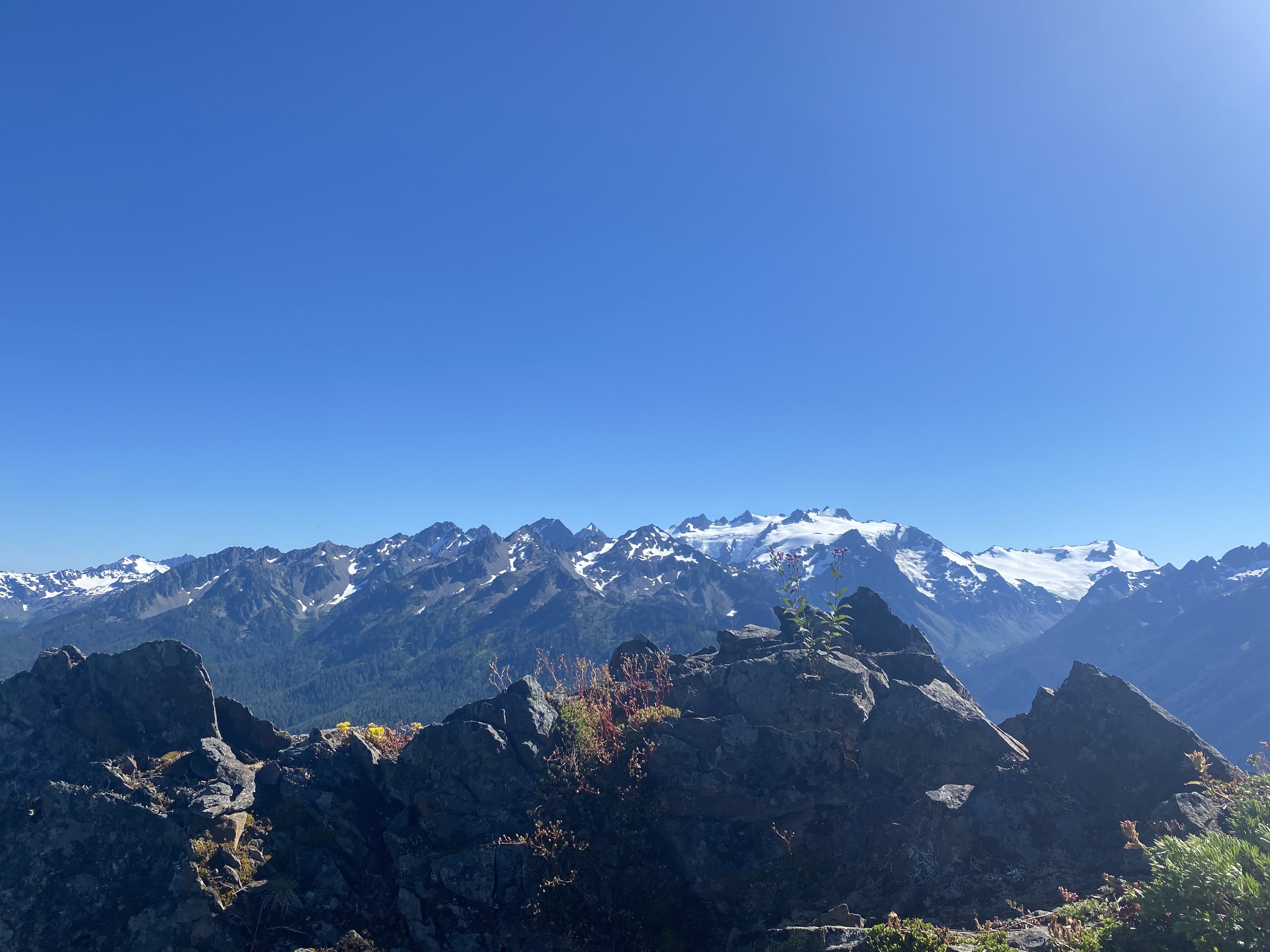
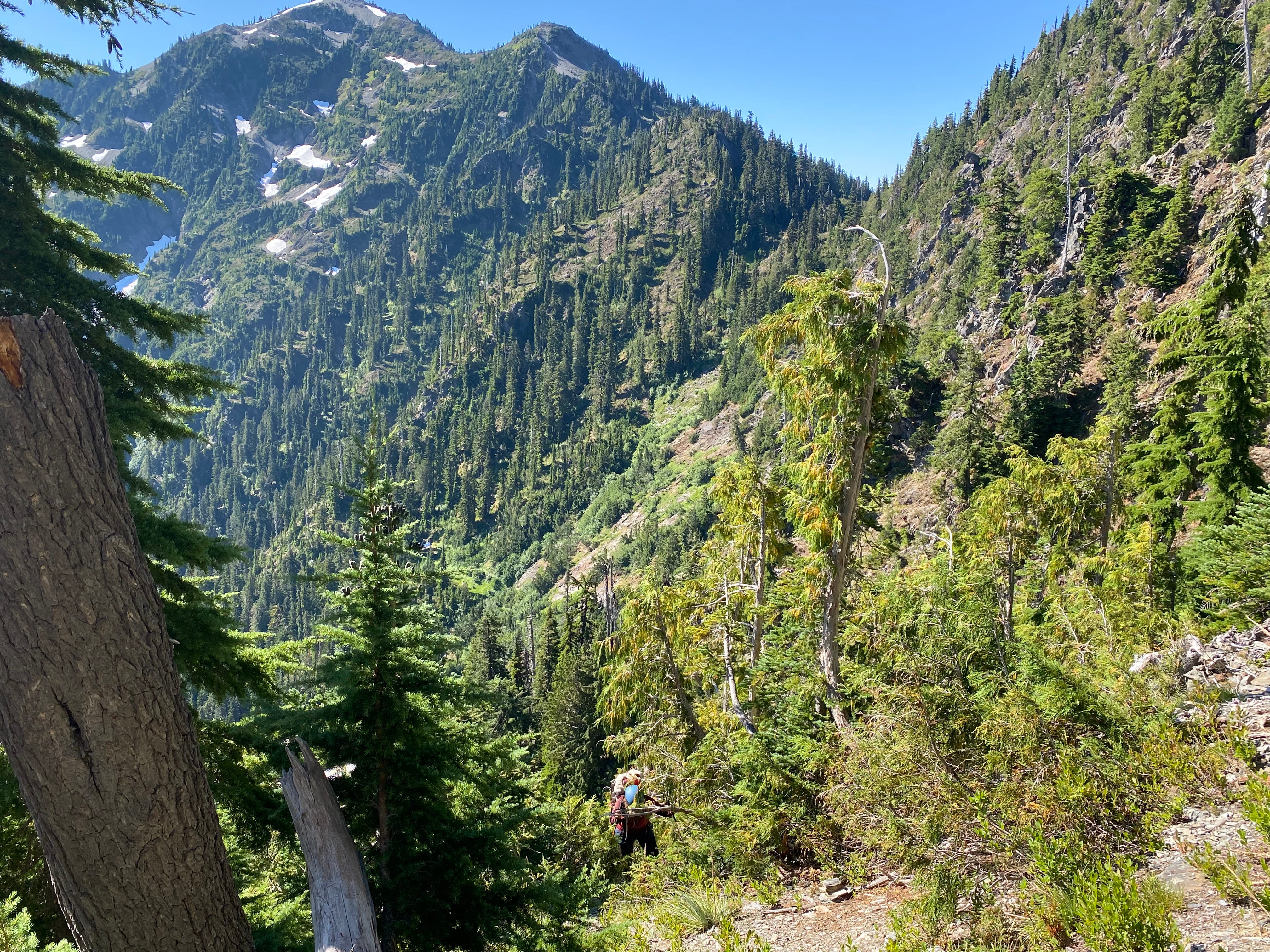
This was a really cool day. Between Lone Tree Pass and Bear Pass, we walked almost exclusively along the crest of the range, undulating up and down through a mixture of snow and rock. The relief into the Goldie River drainage along this section is staggering. The southern Olympics began to come into view. Morale was high.
During the one section where you are not on top of the ridge, we traversed steep snowfields where there is definitely some potential for rockfall. Then, we ascended a low-angle gully back to the crest and resumed our ridge-walking.
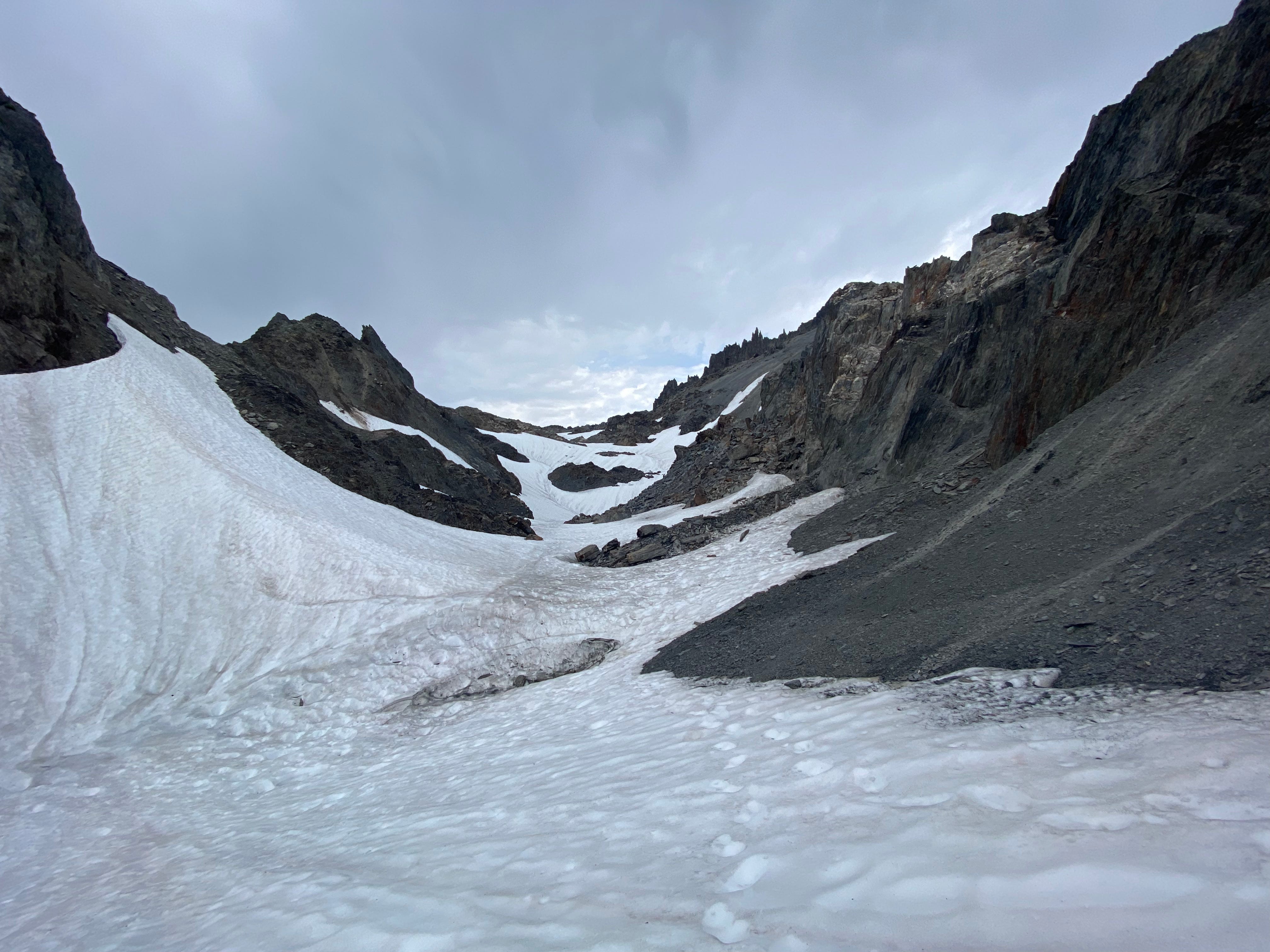
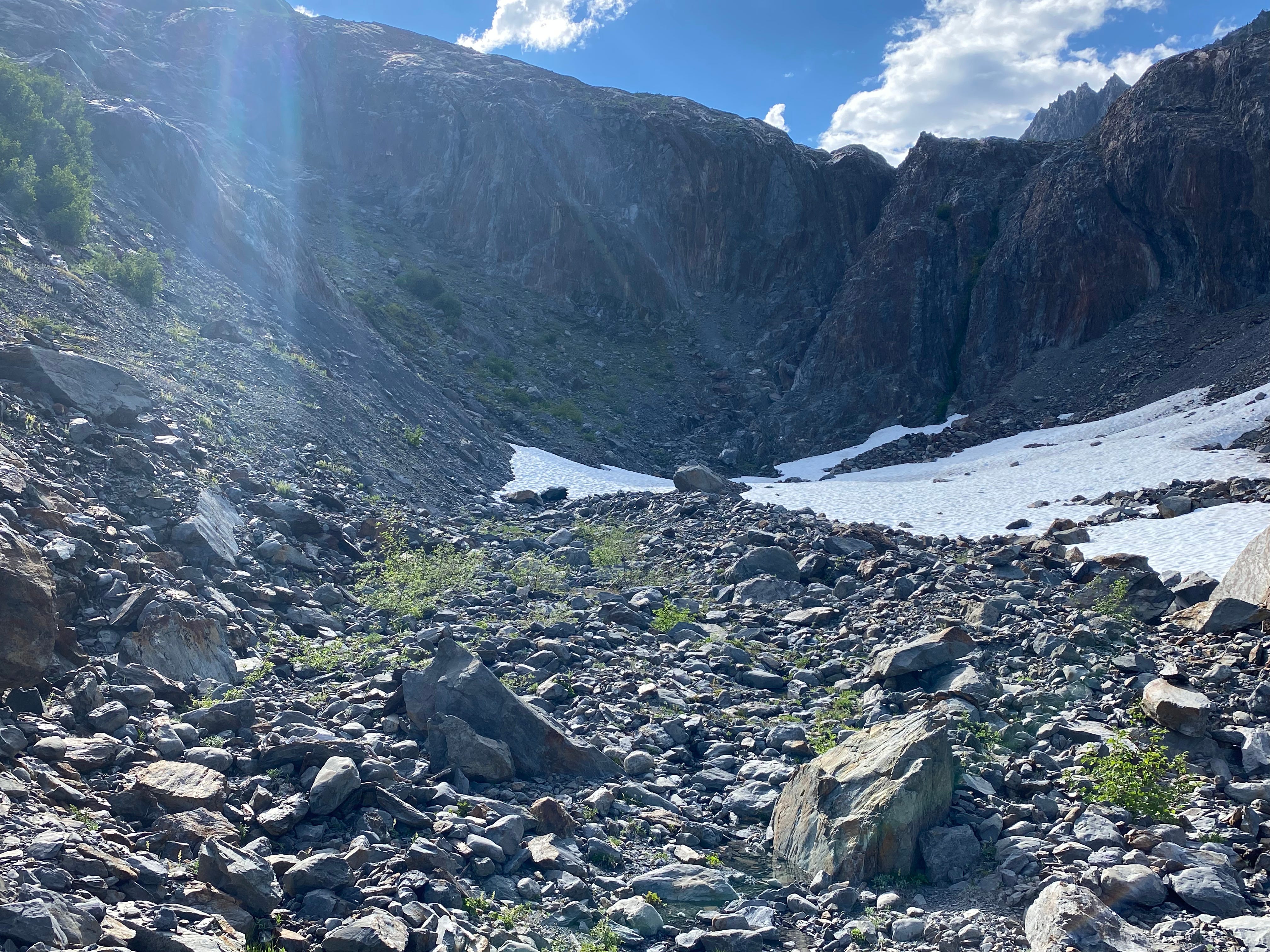
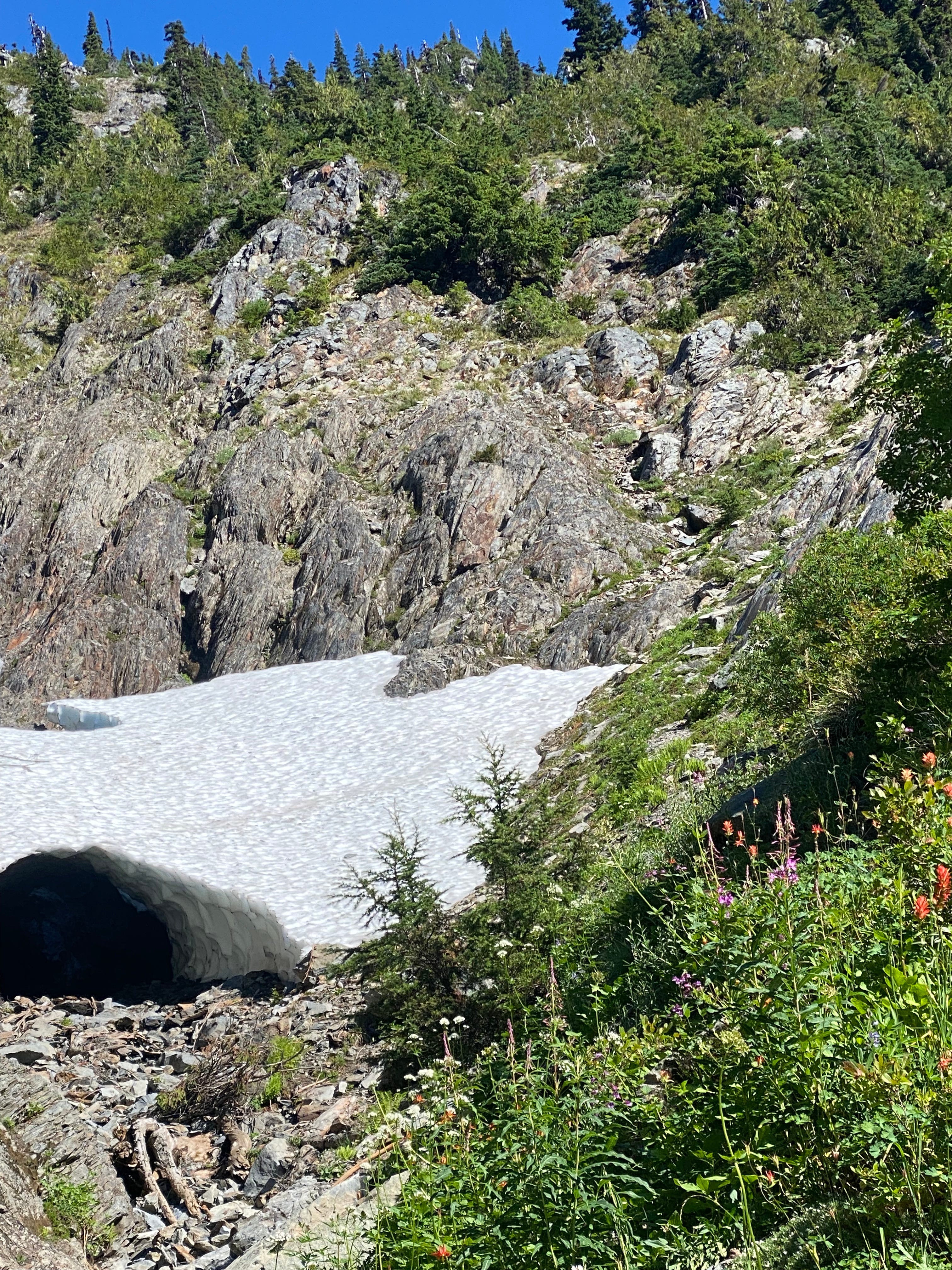
At Bear Pass, we crossed the glacier at the obvious concavity just above 5600 feet. This felt very safe, but if you were concerned, you could probably just walk up and over the top of the glacier, circumventing the snow completely! On the other side, we got our first view of Queets Basin.
The GPS track crosses the Bear Pass Glacier a bit lower, then traverses across a steep slope in Queets Basin to get the to Queets River. There may be some merit to this route, but it would involve crossing some steep snow slopes on the Bear Pass side, and even steeper heather on the Queets Basin side, which we didn’t want to do (we couldn’t see any signs of a trail, even looking back up from Queets Basin at where the track supposedly is). I would recommend crossing where we did, then descending directly into Queets Basin.
Almost immediately after we began descending into Queets Basin, we spotted a bear on a ledge about 100 feet below us. We yelled at it for a while, until it eventually ambled down the hill to the bottom of the basin.
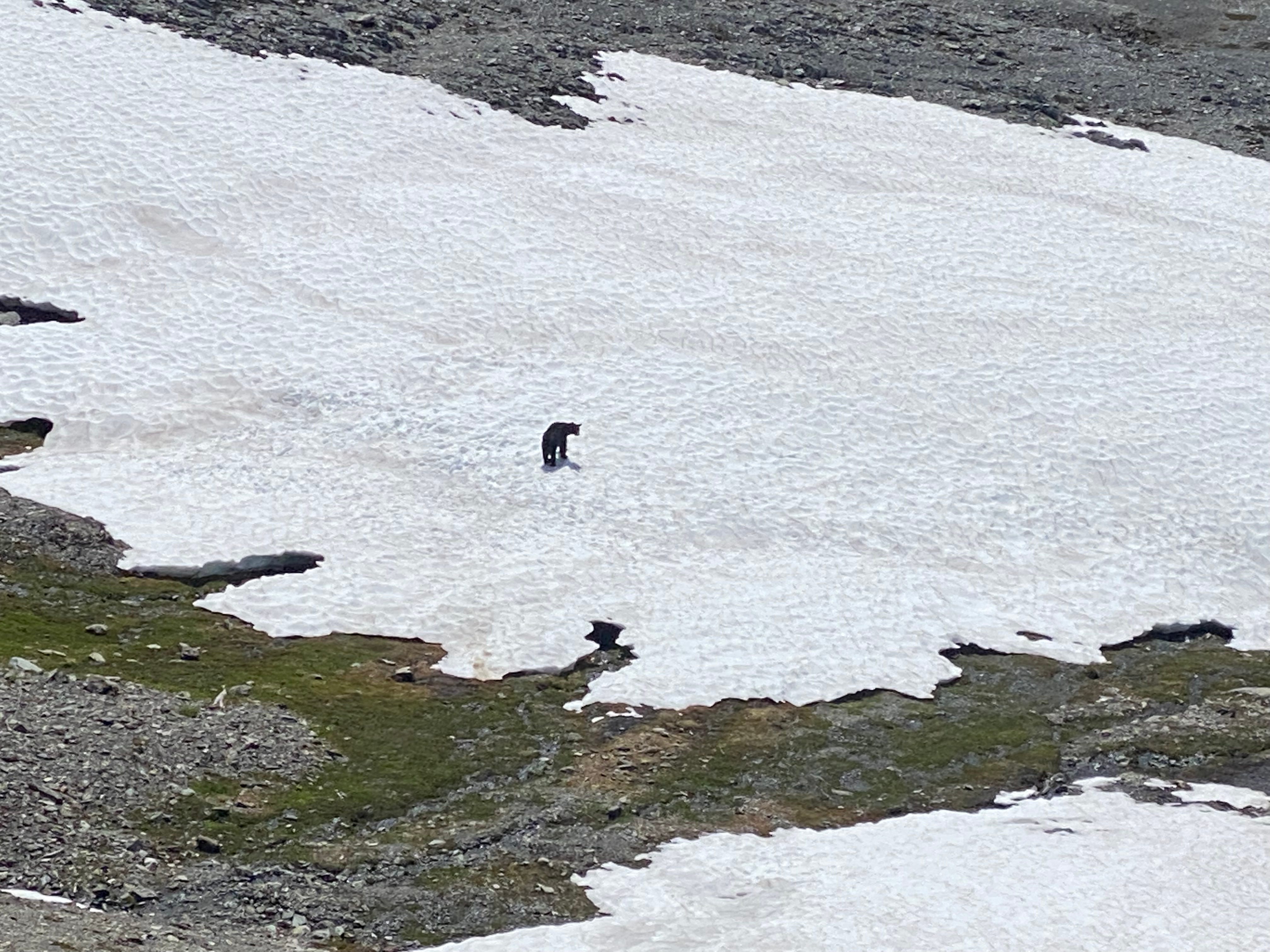
As we descended a similar route to the bear, we actually found its tracks through one of the snowfields we crossed. Evidently, it took a much more direct route than we did!
Once we arrived in the basin, we traversed some very nice meadows along the skier’s right side of the Queets River. There was still some snow, but mostly this part was very easy traveling.
As the meadows gave way to brushier terrain, navigation became slightly less trivial. We had seen in Climber Kyle’s trip report that following the track shown on Gaia as the “Humes Glacier Route” is a bad idea. So, we opted to follow his suggestion of going lower, then climbing back up the streambed on the other side. This worked wonderfully! Thanks Kyle!
This route worked especially well due to the large network of active game trails we found making our way through the brush. I say active because even though we yelled “bear” near constantly as we walked along these paths, we still managed to startle a bear no more than 20 feet away from us following one of the trails. Luckily, the bear ran off in the other direction.
Bear encounters aside, the trails descended at a perfect rate through the brush, and were so well developed that it was at times hard to believe they weren’t made by humans. I wouldn’t even describe what we were doing as bushwhacking; the bears know what they’re doing when it comes to making trails!
Although it does not show up on CalTopo, there is still a hundred foot drop off from the forest into the riverbed. At first, we worried we might be cliffed out. But after searching for several minutes, the bears came to the rescue again, and we found a bear path that perfectly weaved its way down the steep hillside, taking us to the river.
I’d highly recommend that anyone trying to access the Humes Glacier from Queets Basin take this route in the future. It is extremely straightforward navigation, on trail that is better developed than what we’d been walking on for the past 2 days. Compared with the descriptions of the horrors that lie in store if you try to cross higher up, this was a cake walk. Plus, you feel like a badass for walking along game trails.
From here, we climbed up the river bed, taking care to stay left at each of its forks. This too was very straightforward to navigate. We were making great time. To our surprise, about halfway up the climb we spotted another party of 2 traversing a snow slope far above us. Ironically, the only people saw on the entire traverse were at our most remote point!
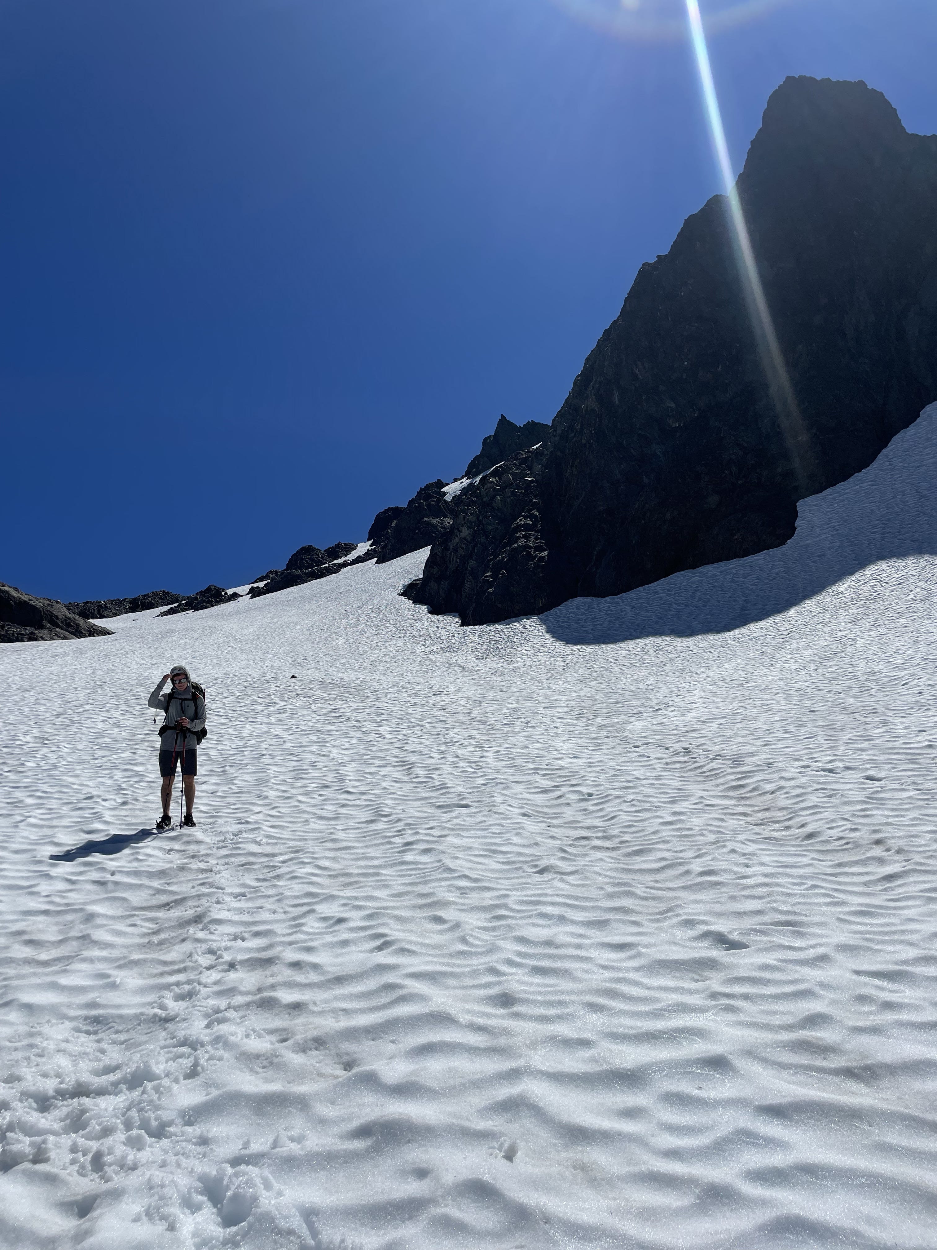
We caught up to the others as we neared the top of the climb to the Humes. They were also hoping to get to Camp Pan that night. After talking for a few minutes, we continued on. The final several hundred feet up to the Humes are on steep slabs, which required some routefinding.
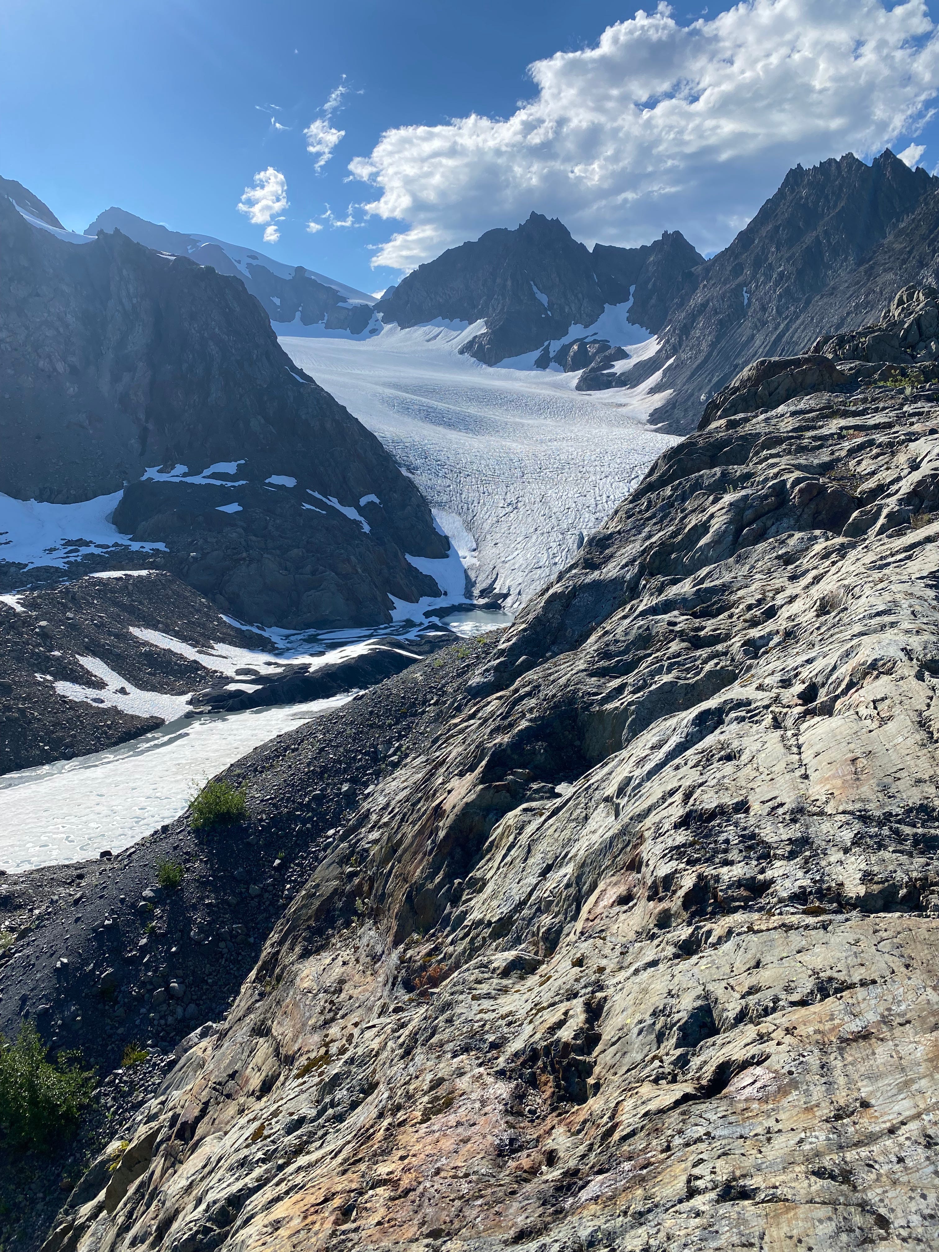
Upon reaching the crest, we got our first clue that something wasn’t right. Where CalTopo and Gaia show flat topo lines and glacier at 4800ft, in reality we found ourselves on a bluff with a steep drop off 200 feet down to a large proglacial lake, with the glacier receded a quarter mile up the valley from where we expected. Evidently, since whenever this area was last surveyed, the glacier has lost a staggering amount of volume. I knew that the Humes Glacier was receded, but what I wasn’t expecting was for the topographic maps to be so wildly off in this zone.
We carefully descended off the bluff to get a better look at the glacier (this was actually pretty tricky; I’d recommend trying to come up the hill slightly further looker’s right than you think you need to to avoid this awkward descent). At this point, the other party of 2 caught up with us (they somehow knew to avoid the bluff), and we discussed what we were seeing.
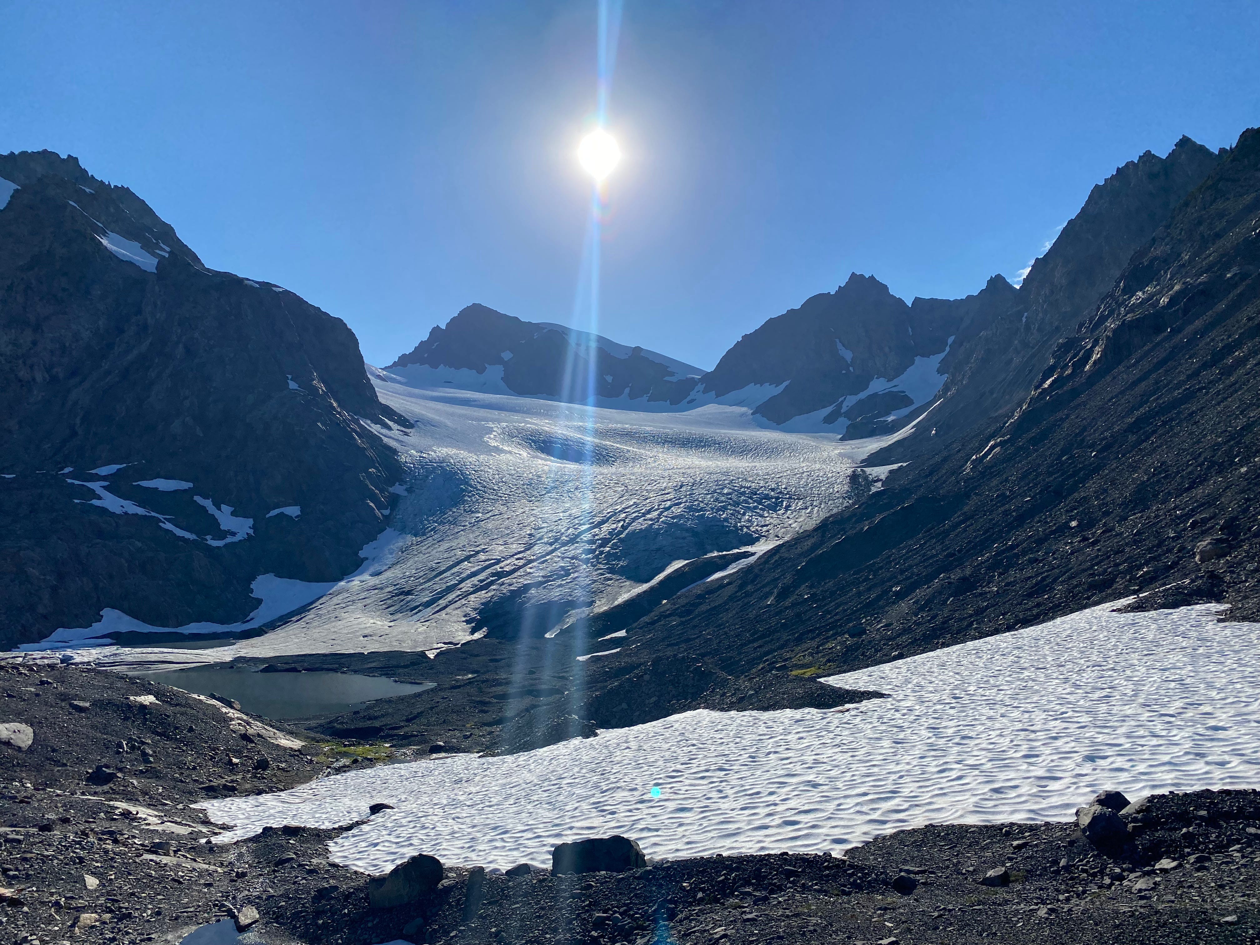
For one, Blizzard Pass did not look completely snow-covered, and looked like it would involve at least a couple of quite steep moves on loose rock to crest. Potentially worse, the blue ice at the bottom of the glacier was much steeper than we had expected: in particular, the looker’s right side of the blue ice was not that steep but clearly in a very active rockfall zone, the middle was extremely cracked up, and the left had no cracks or rockfall but looked steeper than we felt comfortable walking up with no protection (we estimate about 20 degrees).
If you were willing to expose yourself to rockfall, the gear we had brought (trailrunners and strap-on aluminum crampons) may have been sufficient. But not having ice screws and not wanting to get hit in the head with a rock, it felt sketchy at best to try and climb.
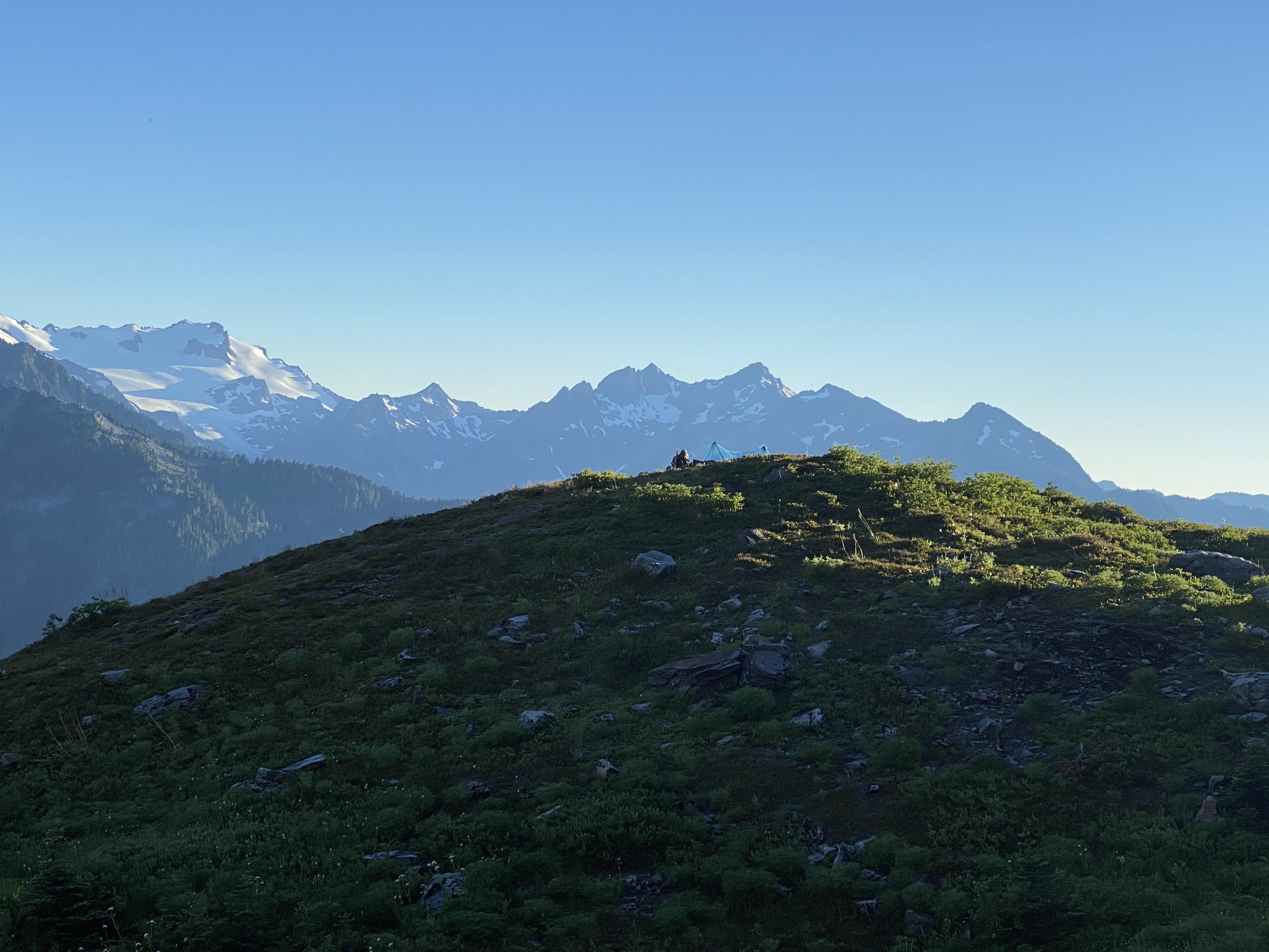
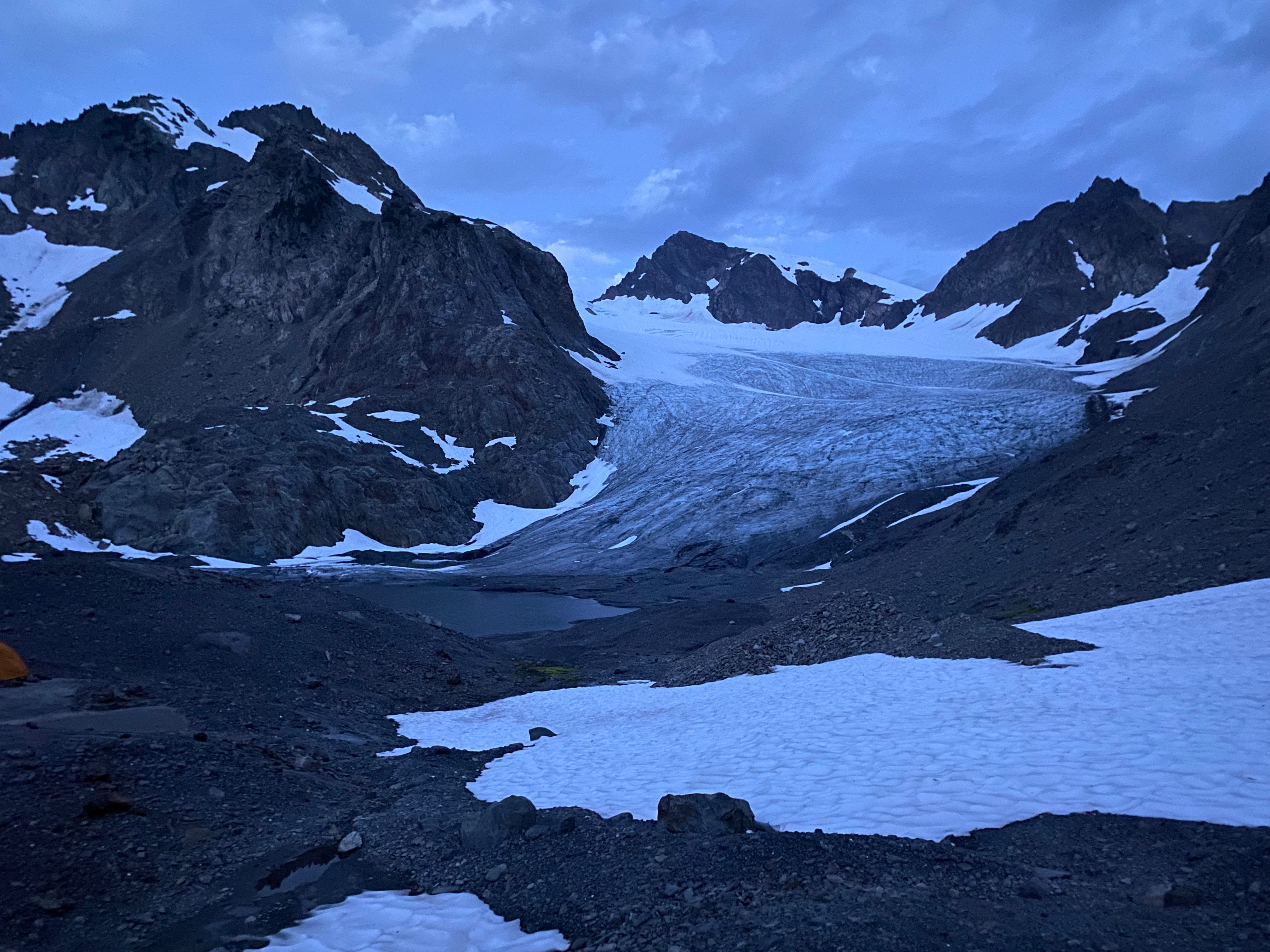
Around this time we also heard from my parents that thunderstorms were forecast in the area for the next morning. Camp Pan, although beautiful, is objectively one of the more exposed places I can imagine being stuck in a thunderstorm (on a nunatak high above the Hoh Glacier). So at least for the time being, there was only one sane choice: stay at the toe of the Humes for the night and consider our options.
After setting up camp (there are a number of decent bivy spots at the toe of the Humes), we sat down to eat dinner with the other party and learned more about them: two brothers, Scott and Eric, who were self-taught mountaineers and had been climbing in the Cascades and Olympics for at least 30 years. They told us about the various adventures and epics they’d had in the Olympics, and explained that they’ve gotten into the habit of always bringing more gear than the guidebook suggests, because too many times they’ve had the experience of arriving at a supposedly easy glacier climb and found the glacier massively retreated and significantly more technical than expected. Good advice, in our predicament! As a result, they had mountaineering boots, steel crampons, and ice screws (not to mention 30 years more experience than us). Their plan was to continue up the Humes as early as possible the next morning, weather allowing, and if not waiting the thunderstorms out from the toe of the Humes for a day.
At this point, it was pretty clear to us that it would be unwise to continue on with them given our lack of equipment. So we asked what they knew about the other exits from the Baileys. They spoke quite passionately against trying to descend out through the Elwha Snowfinger, instead recommending we backtrack to Mount Ferry, then exit out to Dodger Point. They even kindly offered us a photocopied page from Olympic Mountains: A Climbing Guide that described the route, which we gladly accepted.
So, it seemed our exit had been decided: out to Dodger Point, then down the Elwha to the Madison Falls trailhead. We also decided it would be wise to get an early start the next morning, wanting to beat the rain (a number of sections in Queets Basin, especially last several hundred feet up to the Humes, would be fairly dangerous to navigate when wet). So we thanked the brothers for their help and went to bed, ready for an early morning.
Day 4: Humes Glacier to Ludden-Scott Saddle
We woke up at 5 a.m. the next morning to an overcast sky, and were moving by 5:30 a.m. It wasn’t raining yet, which was great, because we were able to get through the part I was most concerned about while the rock was still dry.
The brothers wished us safe travels as we were heading out (they were also awake to assess whether they wanted to cross the glacier that morning). Just as we were walking out of sight of the cliffs that we had camped on top of, I glanced back and saw one of the brothers watching us from the top of the cliffs, making sure we had descended safely. They really were our guardian angels.
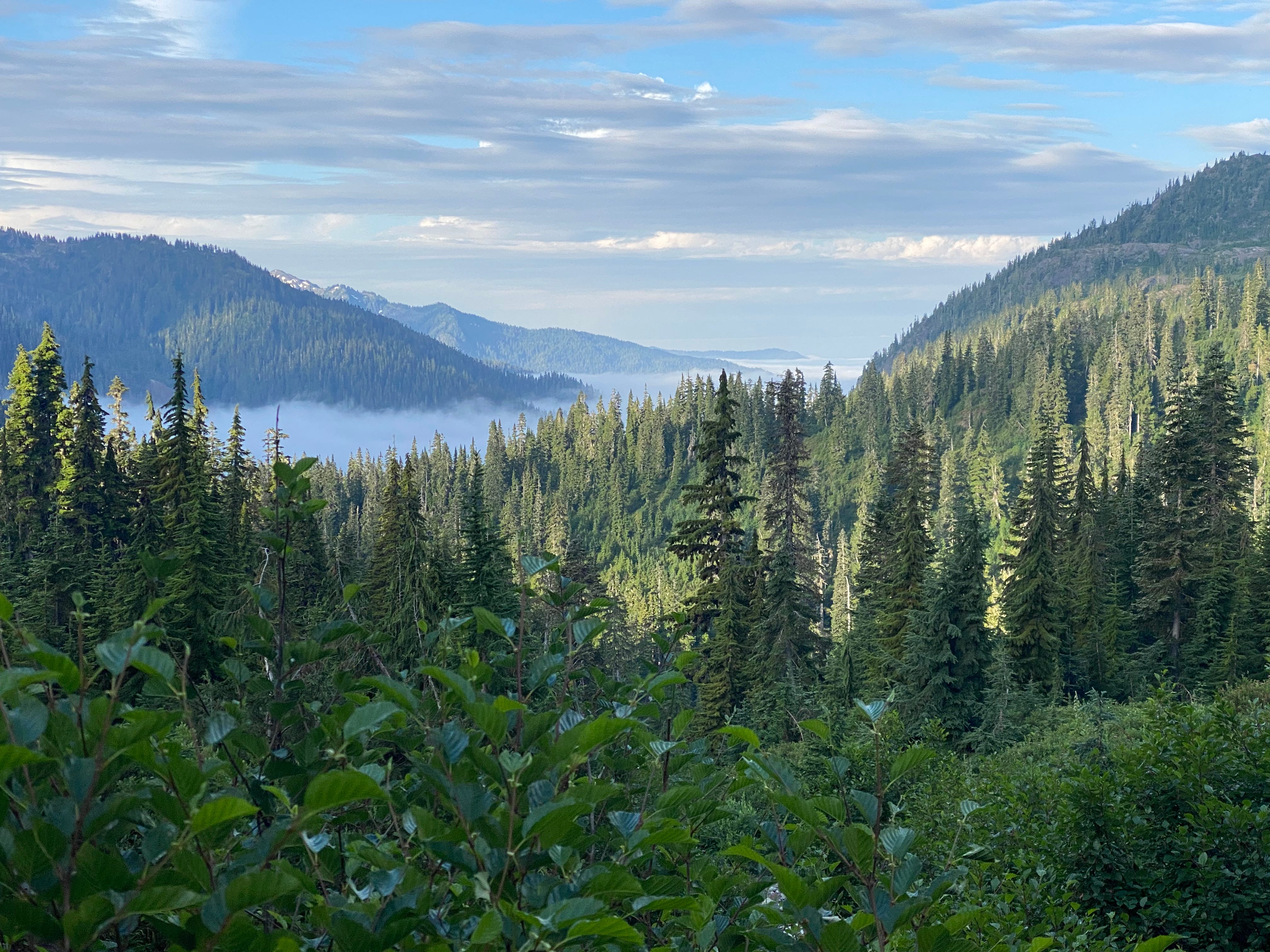
From here, we retraced our steps from the day before, descending the riverbed, then navigating the bear trails into Queets Basin. There was a marine layer below us, and an overcast sky above, but still no rain. Things were going well.
For whatever reason, the bears in Queets Basin were extremely active this morning. We had only seen two the day before, which was still a lot but nothing ridiculous. In the two hours that we climbed back out of Queets Basin that morning, we saw 8 different bears! At one point, we found ourselves trying to traverse a hillside with a bear above us, a bear directly in front of us, and a bear below us (a bear-acade!), all fairly undisturbed by our yelling. After several minutes more of yelling, the bear below us crossed the Queets River and the other two bears went further uphill so that we could keep walking. When we were directly below these two bears, however, they started fighting, which was slightly terrifying given they were only about 200 feet up the hill from us. We kept moving, quickly.
A little later on, we were coming out of a gulley (the bear spray was in my hand at this point), and found ourselves about 30 feet away from a bear that we had seen before entering the gulley, but must have moved closer while we were out of sight in the gulley. It, too, was slow to walk away, but eventually ambled off up the hill after a tense 20 seconds of yelling. All of this was rather intense after a night of little sleep; I’d never had any close-up bear encounters before this trip, and in the span of half an hour had just had 3 or 4.
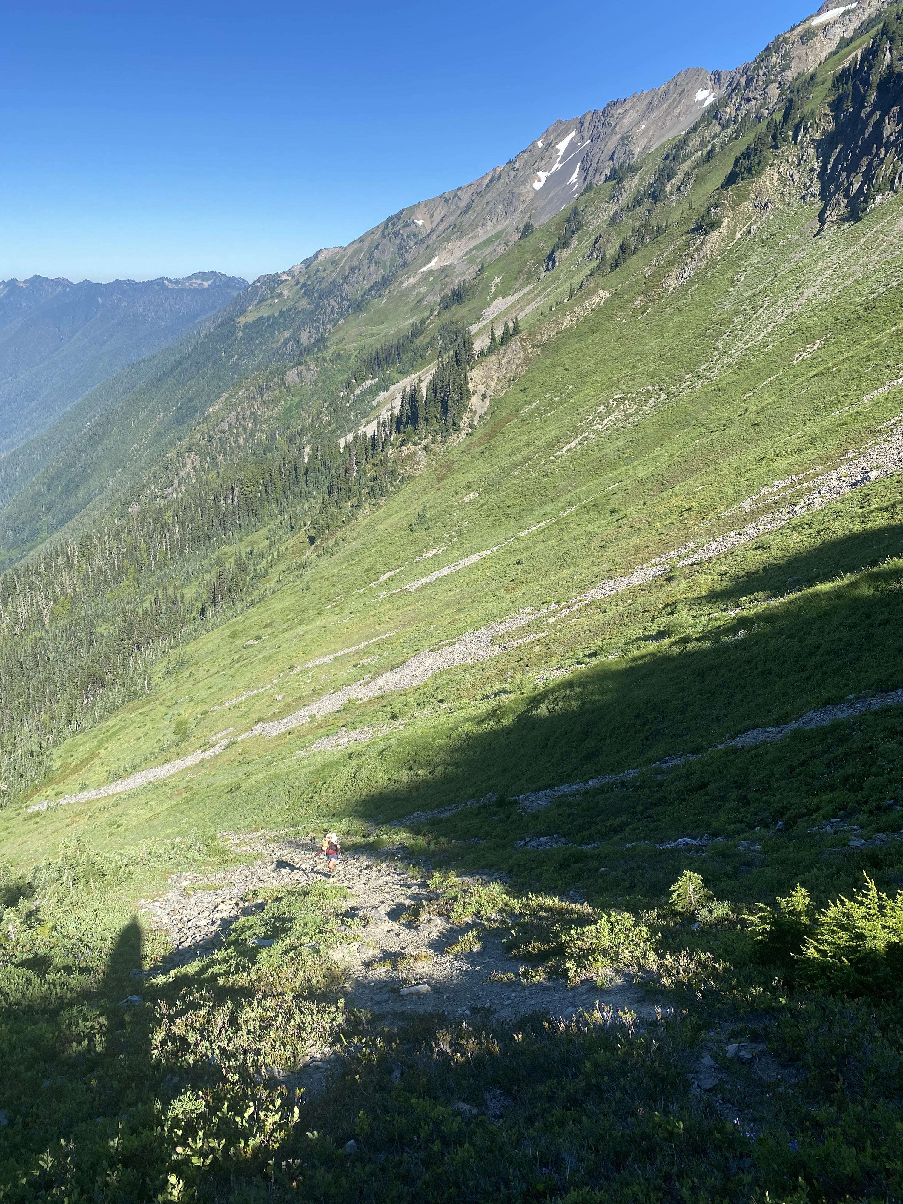
Finally, we seemed to have escaped the bears, and began ascending up the final thousand feet out of Queets Basin. I hadn’t remembered this descent being that bad the day before, but for whatever reason climbing back out it felt very steep and exposed. About halfway up, it also started to drizzle, and we could hear thunder far off (no visible lightning, though). This, too, was a pretty intense experience. Luckily, it never started raining outright, and the rock stayed sufficiently dry to get to the top safely. At the top, we took a nap, already exhausted from a crazy couple of hours. The rest of the day would be ridge walking, and we didn’t want to continue until it was clear that the thunderstorms had passed.
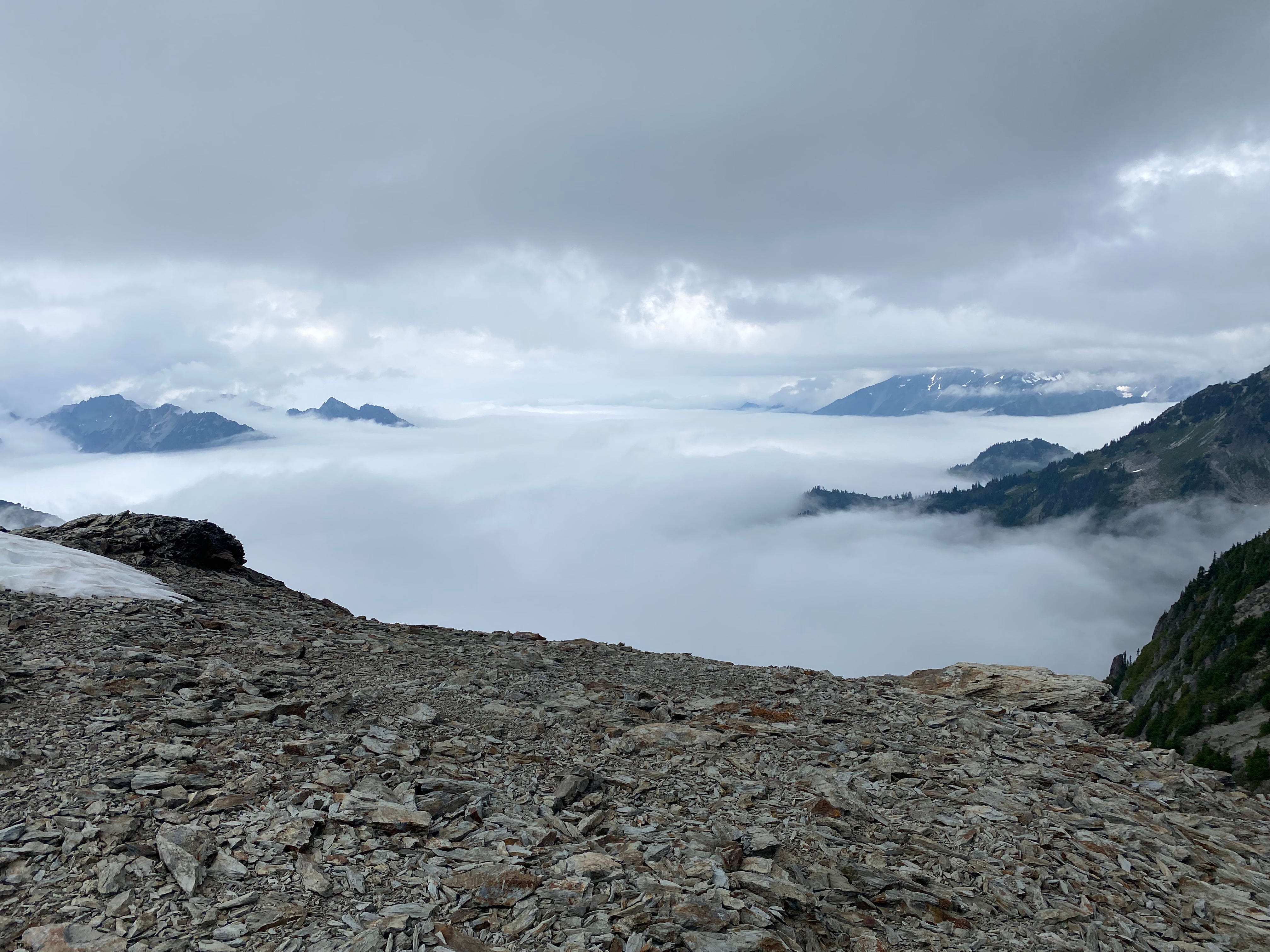
When patches of blue started to appear in the sky about half an hour later, we kept going. The ridge we walked was the dividing line between overcast skies and blue skies, with a marine layer in the valley on one side and nothing in the valley on the other. This section went smoothly, and we made great time. The only part we did differently was walking around below the knife-edge snow feature on rock, since I didn’t feel like walking back down it, which I think was the right choice.
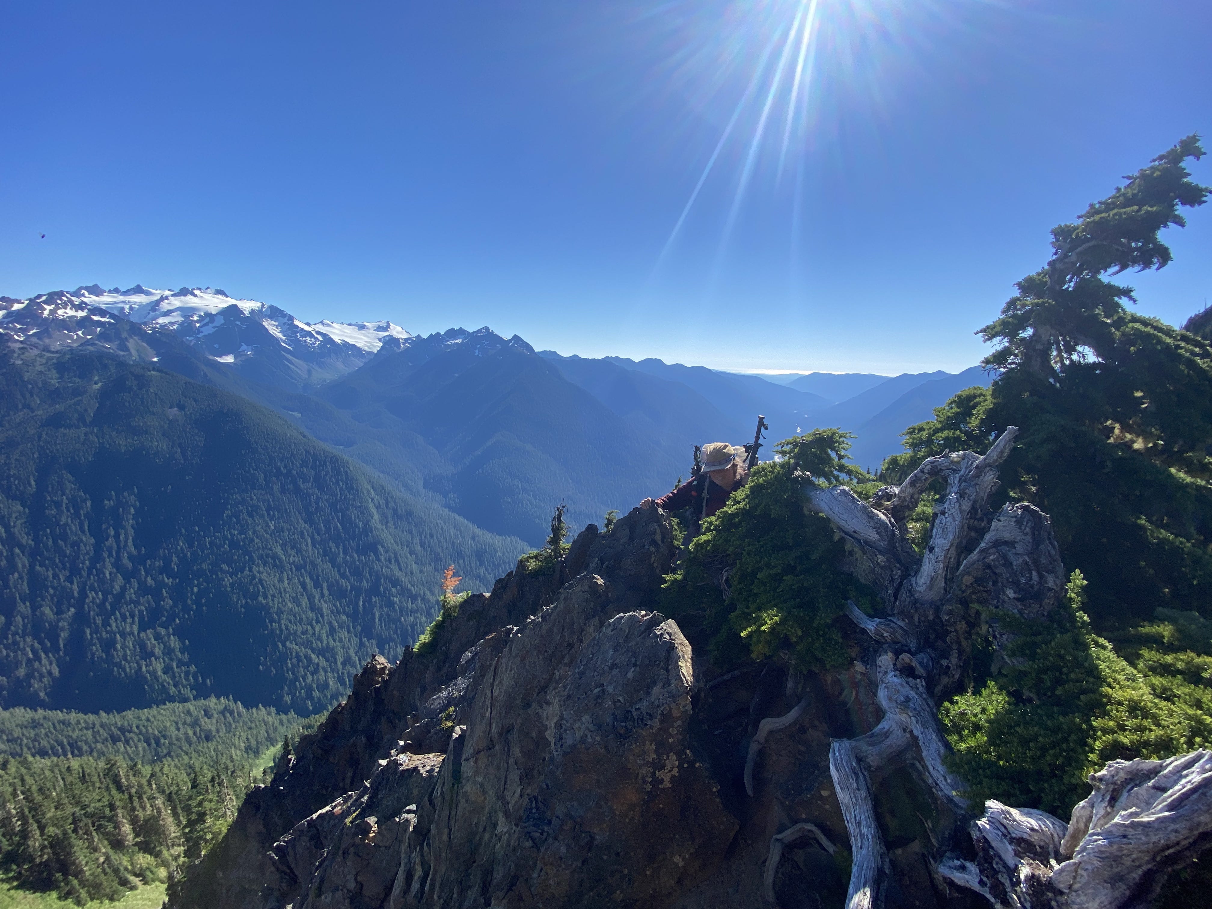
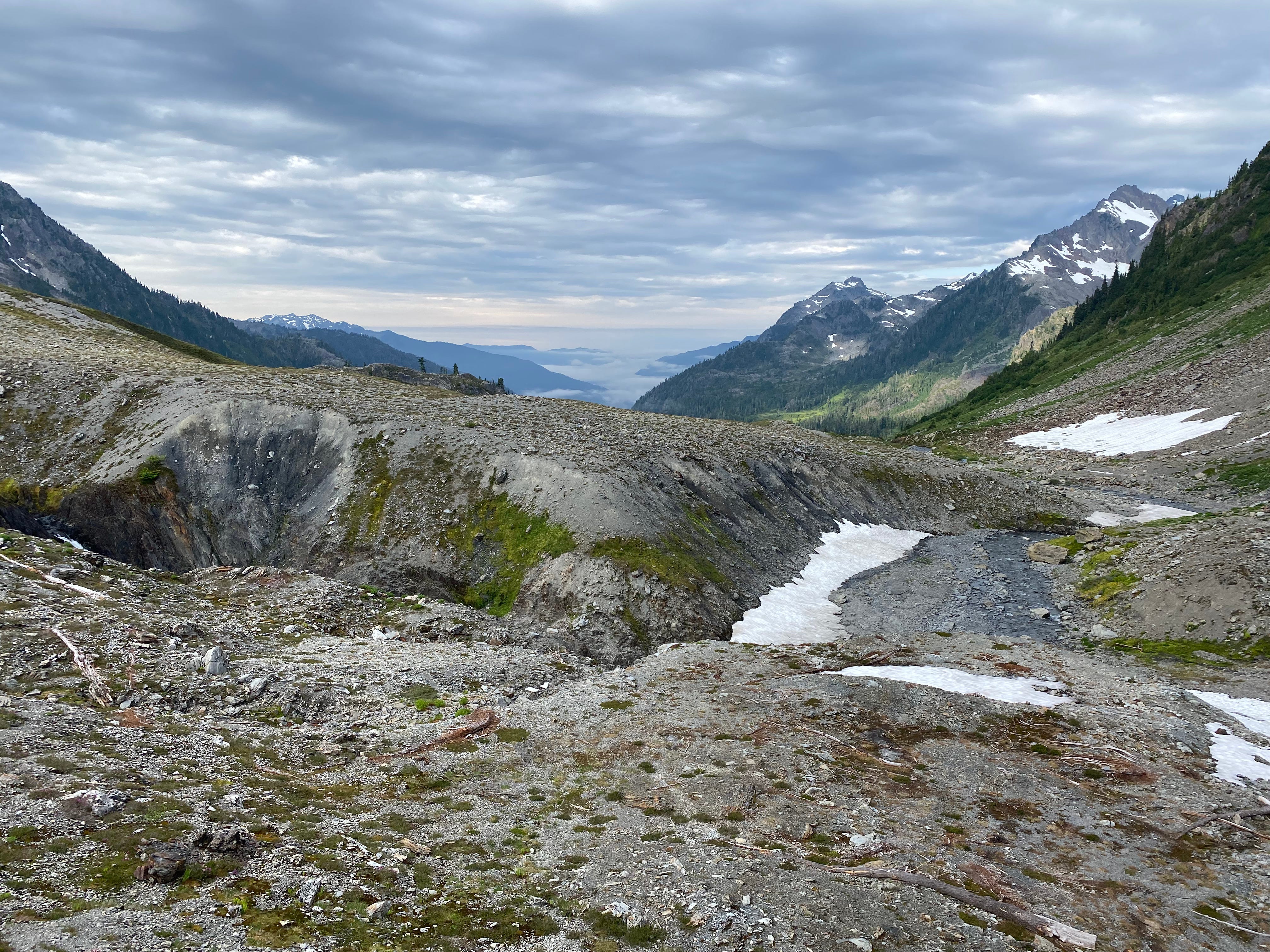
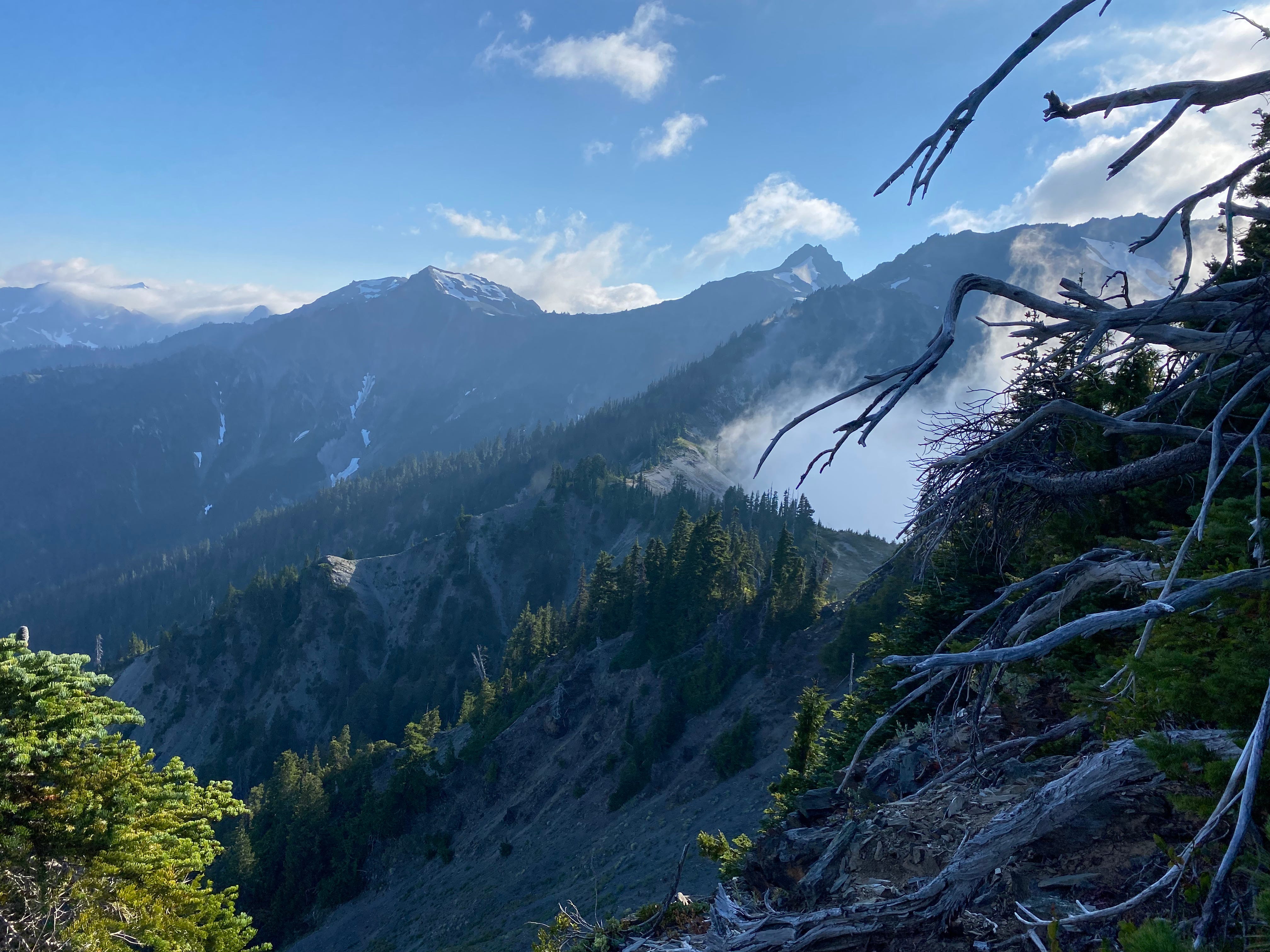
We weren’t sure how far we were going to get today, but after another nap near Mount Childs we arrived at Mount Ferry with plenty of daylight left. So we decided to start down the ridge to Dodger Point, with the goal of camping at the Ludden-Scott saddle.
This section is really aesthetically pleasing. The ridge between Mount Ferry and Ludden Peak is just wide enough to have trees and meadows on it, but drops away extremely steeply on both sides. If this ridge weren’t here, Ludden Peak may as well be on another planet from the Bailey Range; but since it is, getting between the two is actually pretty simple.
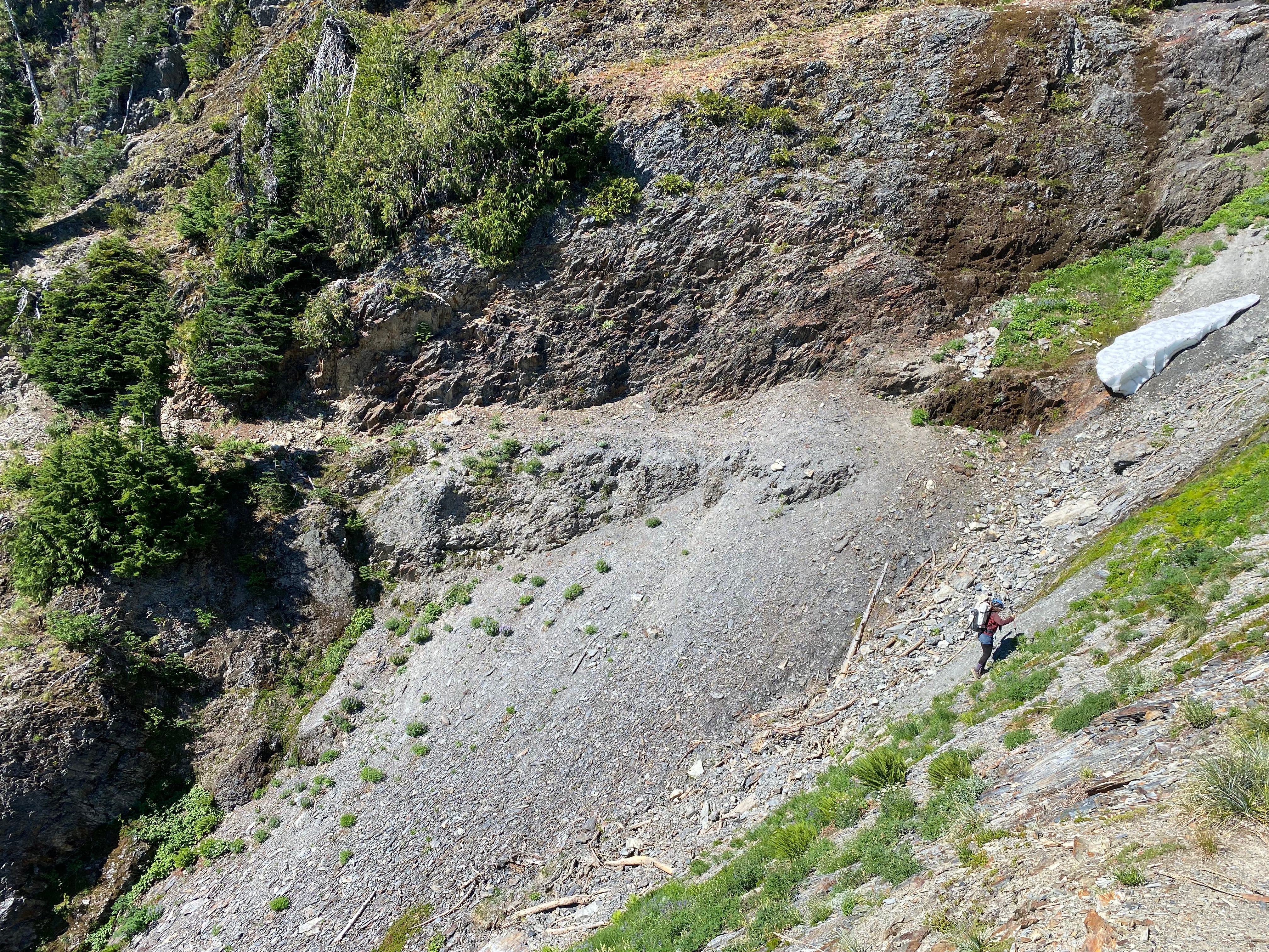
Simple, that is, except for one extremely sketchy part that we both agreed was by far the most dangerous thing we navigated on the entire traverse. Right when the trail drops steeply off of the shoulder of Mount Ferry, it descends then crosses an extremely eroded, steep, loose, and exposed sidehill. If you fell here, which is a very real possibility, you’d die. The guidebook page we had didn’t seem all that concerned by this section, simply mentioning “one short, steep section.” My guess is that the hillside has become more eroded in the last 15 years since the book was written, making it more dangerous. I’d highly recommend scouting this section with packs off before you’re committed, and potentially even lowering packs with a rope if you have one, if not outright rappelling.
Anyway, we didn’t die, and continued down the rest of the ridge, which would’ve been really enjoyable if we weren’t worried about more sections like the previous one coming up. Luckily, the rest of the ridge was straightforward, and had much more vegetation to grab onto in the steep sections.
The guidebook page we had been given came in handy above the Ludden-Scott saddle: On Gaia, the trail leaves the ridge at a certain point and sidehills over to the saddle. We initially followed a trail that started out in this direction, but eventually went far too low and started switchbacking aggressively down the hill. So we returned to the ridge, and followed the guidebook’s instructions: stay on the ridge until right before the cliffs of Ludden Peak, then follow the meadow down to the saddle. These directions worked great, leading us on a reasonably well-established trail directly to the saddle.
We arrived, exhausted, at 7:30 p.m. We had been hiking for 14 hours. Our camp was very pretty, and had good access to water (there had been no water ever since Mount Ferry), but the bugs were pretty bad. This day was truly an epic.
Day 5: Ludden-Scott Saddle to Elwha Ranger Station
We got up at a more reasonable hour on Day 5, excited to only have two more miles of primitive trail navigation before arriving at Dodger Point. Having seen how wrong the Gaia track was for the trail down to the Ludden-Scott saddle the night before, we paid extra attention to the guidebook page this morning, even inputting all of the WGS84 datum waypoints into my phone for extra navigational peace of mind.
The guidebook spent a while describing a feature called “Crisler’s Ladder” (named after one of the legendary early explorers of the Bailey Range, Herb Crisler). Given how little time it had spent describing the terrifying section the day before, this worried me greatly. Supposedly the ladder descended 30 feet straight down on root and vine handholds into a “very steep” gulley with running water and cliffs below. I was sufficiently intimidated by this description that I actually lost sleep over it the night before; in the morning I calmed myself by saying that we had a rope and could always rappel if necessary.
In reality, it wasn’t that bad. The waypoints made navigation to the ladder straightforward (note that once again these waypoints did not even remotely follow the trail shown on Gaia). The ladder itself was honestly a lot of fun - vertical but on really excellent root holds, and the gulley below is basically flat (the cliffs are way further down; there’s no way you’d ever go over them). We climbed down into the gulley with no difficulties at all, grateful to have cleared one of the final hurdles in our escape from the Bailey Range.
The other side of the gulley was actually more of a challenging feature to navigate. The “trail” climbs 400 feet straight up on steep loose hillside. Be careful of rockfall here. It honestly wasn’t that bad, especially considering what we’d already been through, but at this point I was mentally exhausted and ready to be done.
After a bunch of climbing, we arrived at the “hanging rock” feature described in the guidebook (a rock hanging on a piece of string from a tree; we just found a piece of string with no rock anymore, so we retied the string around a small rock), marking the beginning of the Ludden Peak way trail.
Someone definitely put a lot of work into the Ludden Peak trail at one point or another. This is strange because the trail basically goes nowhere, simply ending at the hanging rock, leaving travelers to descend a very steep gulley and climb Crisler’s Ladder if they want to go any further. Even though the trail definitely received professional attention at some point during its history, these days it is extremely eroded, which was pretty annoying since it also traverses a very steep and exposed hillside. We begrudgingly navigated the exposure, very tired of this kind of trail at this point, and after crossing a few slightly terrifying gullies finally reached the forest, where the trail levels out and becomes safe again.
Within a few minutes we had reached Dodger Point. The hard part was finally over!
That said, we were still about 13 miles of trail and 5 miles of abandoned road away from the nearest trailhead at this point. So, knowing we still had a long day ahead of us, after a short break we started knocking out miles.
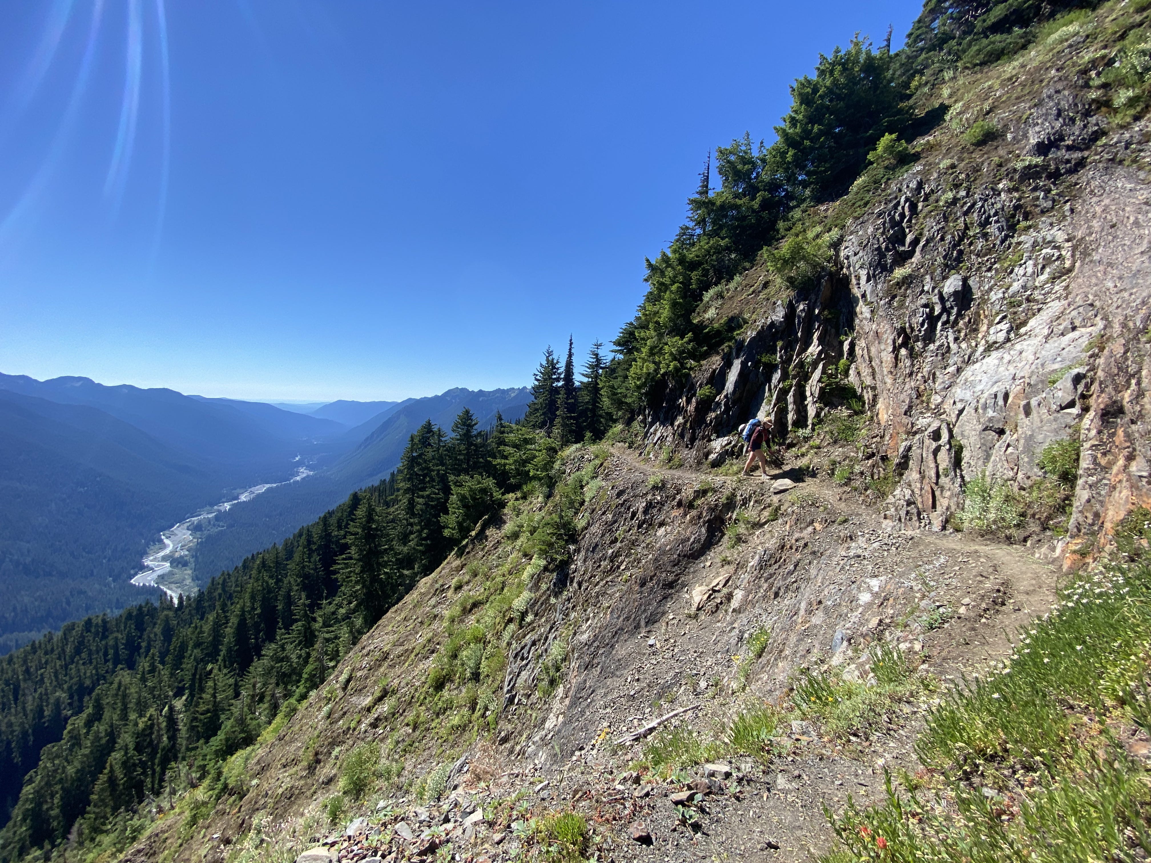
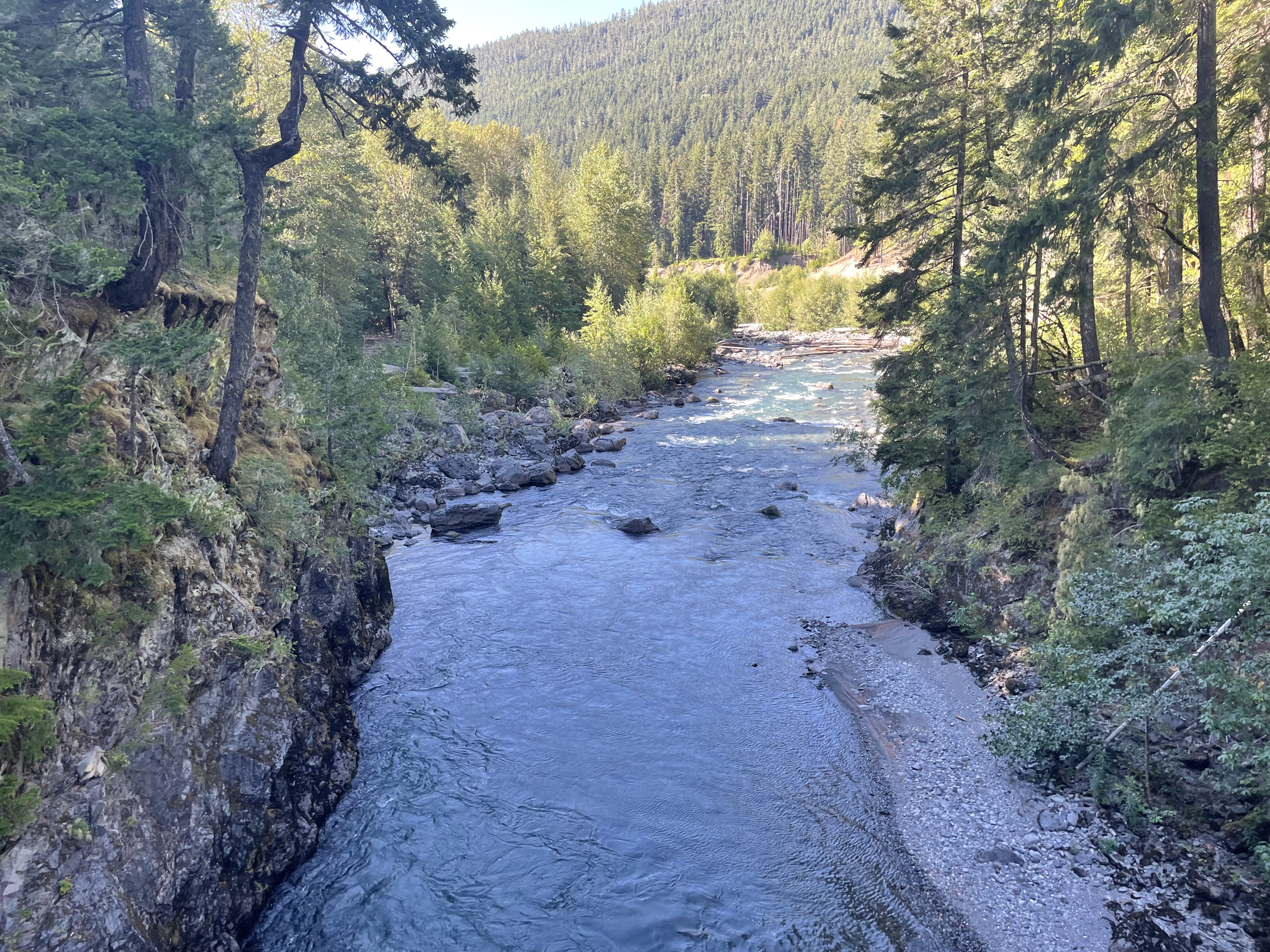
Compared to the Bailey Range way trail, the Long Ridge trail was dreamy. Excellently graded, very fast to walk, slowly descending through a beautiful old growth forest to the Elwha.
Shortly after crossing the Elwha, we followed the signs to check out Humes Ranch (where the aforementioned Herb Crisler used to live). There is a nice log cabin and some informational signs there, but not much else.
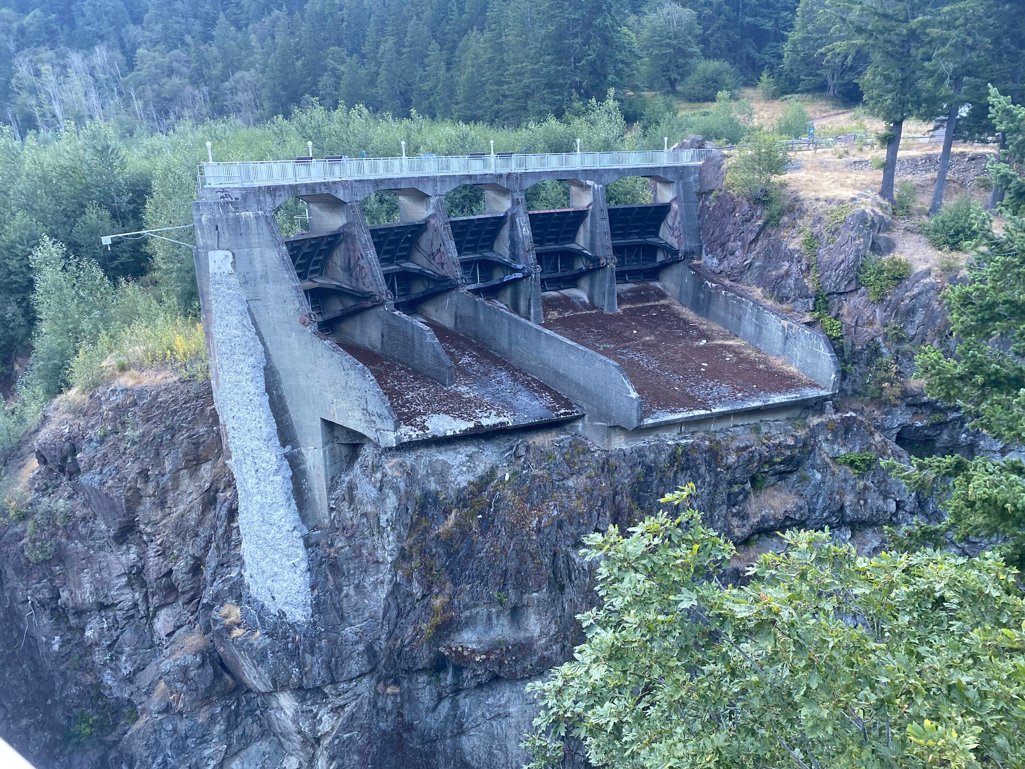
Finally, we reached the road. At this point we had arranged for a ride back to Sol Duc at 9 a.m. the next morning, and so were planning on camping about a mile off from the trailhead at the old Elwha Ranger Station. We checked out the remnants of the dam that used to hold in Lake Mills, but other than that simply booked it to the ranger station.
After another nearly 12 hour day, we arrived at our destination, and quickly went to bed.
Day 6: Elwha Ranger Station to Madison Falls Trailhead
The next morning, we woke up and made our way to the trailhead just in time for our 9 a.m. shuttle. My parents had very kindly arranged a last-minute shuttle for us using hikeolympic.com. We had considered hitchhiking, but the Madison Falls trailhead receives surprisingly little traffic, especially at this time of day, so in hindsight I am glad we had the shuttle because it made things much simpler logistically, and much faster. I would highly recommend this shuttle service if you ever find yourself stranded from your car on the wrong side of Olympic National Park.
After getting dropped off by the shuttle at our car, we drove back to Seattle, happy to have escaped the Baileys in one piece. This was an adventure that I will remember for the rest of my life.
Notes:
Regretfully, I did not record a GPS track, in order to ensure my phone had enough battery for routefinding via Gaia.
Before heading out, I implore you to pick up a copy of Olympic Mountains: A Climbing Guide and make a photocopy of the relevant pages. The included descriptions and waypoints were extremely helpful in our exit to Dodger Point, far moreso than the line shown on Gaia.
For most of the traverse, we navigated using the GPS track shown in Gaia’s “Satellite Topo” layer. For the northern Baileys, this track was remarkably accurate. However, for the southern Baileys, Humes Glacier route, and Dodger Point exit, the line bore little resemblance to reality. Mostly, this didn’t matter, since it was obvious where to go, but for the Dodger Point exit, following the track would have been problematic, as there is a plausible but incorrect trail that heads in that direction. Hence my above comment about using a guidebook.
Like Climber Kyle, we wore trailrunners (actually, I just wore tennis shoes) and strap-on aluminum crampons. This was fine for the non-glaciated parts, but I’m really not sure crossing the Humes Glacier is a great idea without mountaineering boots and ice screws. This will likely become even more true in the coming years as the glacier continues to recede and steepen. I’d recommend bringing both approach shoes and mountaineering boots; basically everything past the catwalk wouldn’t hurt to wear mountaineering boots for, and in some places I would have felt significantly more comfortable with a Vibram sole for traction.
We also carried a 50m rope, a picket, ice axes, a probe, and a full crevasse rescue kit, although we never used any of these things other than the ice axes and probe.
Timing-wise, the Humes Glacier and Blizzard Pass would have looked much more appealing to ascend with 1-2 less weeks of meltout. Mountain Madness’s Bailey Range trip (which ascends Olympus directly via the Hoh Glacier) occurs in mid-July, and I think this timing is right.
The level of commitment really cannot be overstated. For much of the traverse, you really couldn’t leave the ridge even if you wanted to: the side of the ridge draining into the Elwha is so steep and loose that even rappelling would prove quite tricky, and the side draining toward the Hoh, when low-angle enough to descend, just takes you further into the wilderness. The Queets River also turns into a canyon directly below Queets Basin, and so isn’t a viable exit. If you get hurt, the only way out is by helicopter. The only real ways out really are just the Humes Glacier exit, the Dodger Point exit, and the Elwha Snowfinger exit, and each of these have their own downsides. Carefully research your backup plans before coming out here, since there is a reasonably high chance you will have to use them.
Another exit option that I would like to explore someday is to continue south from Queets Basin, traversing along the obvious route to the west of Mount Queets and Mount Noyes, then intersecting the Skyline Trail and continuing out to the North Fork Quinault trailhead. I think this is the route that Herb Crisler originally followed in his inaugural explorations of the Bailey Range, and given the looming disappearance of the Elwha Snowfinger, another non-glaciated exit option from the Baileys would be very welcome.
 | A guest post by
|
Best trip report I’ve ever read!